50 Times People Found Such Strange Things On Google Earth, They Had To Share Them (New Pics)
InterviewOne of the most powerful online tools at your disposal is the sprawling Google Earth project, which allows you to use satellite imagery to view a three-dimensional representation of the planet, including impressive landscapes and bustling cities.
While using the program, you can stumble upon some truly bizarre finds and curiosities that you might feel compelled to share with others on the internet. One place where you can do this is the popular ‘Google Earth, Structures and Anomalies’ group on Facebook, which documents some of the weirdest and most interesting places people have stumbled upon on their computers and phones. We’ve collected some of their most recent unusual pics that you can look at as you scroll down.
Bored Panda got in touch with the super-friendly team looking after the online community, and the group's creator, Josie, was kind enough to answer some of our questions. You’ll find what she shared with us below!
This post may include affiliate links.
My Son Found This On Google. My Father Teaching Him How To Ride A Bike When He Was 2. My Father Passed Away In 2022
No blurring? Im new to all this so it's a legit question. Sorry if Im pis§ing anyone off asking.
Why would you be pissing anyone off? It's a legit question. I too am surprised it wasn't blurred.
Load More Replies...The photo that GE had of my house was after a HUGE Ice Storm in October 2020. You can see the huge debris pile in my front yard that was waiting for the city pick-up. It took four of us, from Sun-up to sundown, 2 days to clear the front and backyard of all of the big a*s limbs, that came down in the storm. We were some of the lucky one that only went a week without power, some went 3 weeks, because there was so much damage to the Power Grids.
I wanna know how to view previous images cause all of ours were recently updated!! Like pic of my house was updated for the first time since we moved here (four years ago) less than a month ago 🤦🏼♀️ and I wanna see how far images go back at my childhood home too
When in street view on google maps via browser, click on see more dates in the black box under the search bar. Included a image as I'm rubbish at explaining. image_2025...91-png.jpg
Has anybody else noticed how Google Maps Street view no longer works as well as it use to? It is a lot harder to move along roads using the arrows. It either does not let you move down certain roads or randomly puts you into other roads. WHY? It use t work great. How can Google make it worse?
It didn't always. And even when they started blurring, it was haphazard.
Load More Replies...Google Earth Photo Of The Inman Railroad Yard; Atlanta, Georgia
Not only is it spectacular, it is also complex.
Load More Replies...I live just south of Atlanta and had no clue the size of the train yard.
These Streets In Nova Scotia
LOL I think we have These street in Winnipeg. I know we have Planet street and then the other crossing streets named after planets.
I had a friend who used to name her animals weird names. Your Dog, Oh Sh*t, Oh No, Not Again, etc. She lived on a farm and people were always dropping off stray cats. She and her husband were creative!
It"s not a sh*t neighbourhood. It is really pretty, with an lovely view of Porters Lake. Mostly elderly people buy these homes bc they're very inexpensive and you lease the land, which means you don't have to worry about certain things like septic tanks, etc. It's fairly quiet, but grocery and hardware stores are only about 7 minutes away. It's kind of hard to explain. Nova Scotia is really beautiful. Hubby and I moved here from Ontario in 2021. Completely different vibe here.
Load More Replies...Bored Panda had a friendly chat with Josie, the founder of the brilliant ‘Google Earth, Structures and Anomalies’ group on Facebook. We were curious to find out how the community has changed as it continues to grow, and whether there have been any new challenges that came with this.
For one, the team running the group had to expand. "The only changes we have had to make is to take on some more moderators as the group is growing," Josie told Bored Panda.
However, she mentioned that the people in the community "are still the same." She joked that they still "generally like to argue over everything."
"All in all, the growth of the group is still on the up," Josie said, adding that people enjoy engaging with each other within the group.
Our Advice To Drivers Wanting To Reach The Neighbouring Beach
Not only google can be wrong. I once sat with my neighbours, that all had houses on a small rural road and was told off by a state representive, that we was not allowed to only maintain the road up to the last house, but the whole road, leding over a small mountain and ending at a bigger road 10 kms away. We where confused as the road was a dead end. However, one of the older guys could recall that it indeed had been a long road there, in the 1930s. State map still had it and had been calculating with that for major evacuations in case of wildfires. Lucky they fiund out now, before any event. I later looked at the road, and some very small signs could be detected under the trees.
Recently read that google was having drivers go over a bridge that was no longer there and in the dark, people were driving off the ledge. I cant imagine.
With modern LED headlights, you'd be able to see if a bridge was there or not
Load More Replies...Google still presents roads in our neighbourhood which are non-existent anymore since 15 years. 5 years ago they added "road is blocked" on the traffic layer. Still tourists with campers or caravans get trapped when they try to reach on of the numerous camp sites at the beach.
There’s a road from my condo complex that leads into the neighboring complex. The neighboring complex put up bollards to block it before even a single unit sold in my complex. They didn’t want our residents to cut through to get to the traffic light at the busy main road (our complex’s entrance at the main road has no traffic light). It’s literally been almost 20 years since this road was built and immediately blocked, and at least once a year each of the major map services edits that spot to show as open (not all at the same time). It usually gets corrected about a month later. But it keeps happening like clockwork every single year. Delivery drivers curse every time it happens.
You Never Know What You Will See Scrolling Through Google Street View
Crab In Northern Chile
The Nazca lines are in Peru, not Chile, so this will be some other glyphs.
Load More Replies...Nazca lines. Pretty well known and not exactly a 'bizarre find'.
It's not the Nazca Lines, it says Chile and they are in Peru. Chile does have lots of random glyphs in the Atacama and they are much less well known.
Load More Replies...Meanwhile, we asked the creator about the most fun aspects of using Google Earth, as well as the features that she and the other moderators wish the program would include in the future. She shed some light on this for us.
According to Josie, the most fun part about using Google Earth remains "the same exploring" of the planet we all live on, as well as "finding new things" that we didn't know were there at all.
Meanwhile, she shared a couple of ideas for how the Google Earth program could potentially be improved to make it even more user-friendly. One suggestion is to create a tool "to go back in time," while another idea is to "bring back an easy way to mark your location."
In Egypt We Have A Very Old Movie Theater In The Middle Of The Desert, It’s Never Been Operated And Most Of Egyptian Doesn’t Know Anything About It, Actually There Is Not Much Information About It, I Find That Very Creepy
Found an article about it! https://www.atlasobscura.com/places/end-of-the-world-cinema
I lived at the MFO camp nearby in 2000. Actually walked around the remnants of the theater, definitely a shithole. In the evening just after the sunset the winds are horrific-- imagine a hot blowdryer in a s****y gas station and you get the idea. One thing they don't mention- the nearby camel graveyard-- hundreds of dead camel carcasses rotting away.
This is so atmospheric. Open air cinema in the desert surrounded by ancient rock formations or remnants of ancient Egyptian buildings. I'm sure tourists would love to visit.
Gulliver Park, Spain
I might be missing the joke here, but I thought it was to act out being a Lilliputian climbing on Gulliver from Gulliver’s Travels (sorry if that’s obvious - I sometimes find it difficult to read tone).
Load More Replies...Pomezia (Roma, Italy)
No no no, it's clearly a weather balloon and actually nothing really happened.
You’ve probably used Google Earth, which was originally created in 2001, over the past couple of decades for fun, navigation, studies, or work at some point in your life. In short, it is a web and computer program that takes satellite images, aerial photography, and GIS (Geographic Information System) data and superimposes all of this on a 3D globe.
This then allows you to view locations from various angles. And if you’re anything like us, you’ve definitely searched for your home on the app.
As If, Back In 1593, They Knew There Would Once Exist Something Like Google Earth
That multi-pointed star shape is a fortification. https://en.wikipedia.org/wiki/Bastion_fort
To deflect things thrown at the walls like cannon balls
Load More Replies...I saw the center and the words not the symbol and read PIZZA GRANDE
Was there last summer! Fascinating place. Palmanova is a UNESCO World Heritage Site and a unique example of Renaissance urban planning.
The angled walks were intended to deflect stones launched by trebuchets and ballistas
The "beauty" of war. This is to increace you canon exposure whhile decreasing theirs.
Crazy How The Aral Sea Got Drained So Much. Wow
The big island in the "before" photo was where the Soviet Union previously had its biowarfare lab. No worries at all that people can now walk to the location....
I wonder how much time passed between the two photos... Either way...droughts have devastating effects.
No drought. The river feeding it got re-directed decades ago, when the USSR still existed, to water some agricultural arwas for profit. Without any steady supply, the lake just vanished. The former coast is littered by the remnants of a former thriving fishing industry. Beautiful example how tampering with nature can ruin human and animal life.
Load More Replies...Oof. I had family in the 70s and 80s in Mojave Valley. The soil would become crusted with white salts from the rapid evaporated water of the Colorado River. My cousin used to get Valley Fever from the dust.
Load More Replies...The USSR was supposed to have feedback loop of water to keep the Aral Sea full, with water from mountain sources piped in from Siberia. However the division of the USSR ministry of Argi that did the draining got their operation up and running in a year, and the USSR division that was supposed to handle the refilling never got started beyond paper plans. And that is why this is how it is, and even today, there is Central Asian politics with Russia about Russia's obligation to refill it, and Russia refusing bc these countries were part of the USSR
Military Jet Caught On Google Earth 2018 Over Ouachita Mountains In Southeastern Oklahoma
A plane? Pff, no. I am pretty sure that is the Nyan Cat just travelling over the UE.
Knowing Karina, I don't think she meant any offense. But it's hard to show context in a post
Sounds like a comment about the rainbow 🌈 colors to me too
Load More Replies...Went through there last year when I took my daughter to watch the full eclipse:) LONG drive with no stops. Absolutely beautiful though. No speed limits posted but the minimum speed posted every few miles along with “far left lane is a passing lane only” and how they enforce the rules with ticketing. But the gist was they want you off their land ASAP. It’s like a 3hr stretch through tribal land with no stores or anything. :)
You can also use Google Earth to explore the planet and various cities, locations, and landscapes using coordinates. The program covers most of the globe (97% back in 2019). However, some governments view it as a threat to national security, and the program is banned in some nations. Meanwhile, certain sensitive locations (for instance, military facilities) are censored for obvious reasons.
In 2019, the program had captured 10 million miles of Street View imagery and 36 million square miles of Google Earth imagery, covering most of the planet. Meanwhile, as of 2020, around a billion people use Google Maps, launched in 2005, every month.
Another Crashed Plane, This Time A Bomber From The Second World War I Think. Found Between Russia And Alaska
I'm puzzled by the location given. Wouldn't "between Russia and Alaska " be in the middle of the Bering Strait?
I found the area where this is supposed to be according to the FB post, but there's nothing to see: https://www.google.de/maps/place/64°47'15.7"N+143°31'43.1"W/
No, it says second world war I think... So, I think and not read like 1 think 😉
Load More Replies...In An Isolated Corner Of Kazakhstan, There's A Large Pentagram, Measuring Roughly 1,200 Feet (366 Meters) In Diameter, Etched Into Earth's Surface. The Five-Pointed Star Surrounded By A Circle, Located On The Southern Shore Of The Upper Tobol Reservoir, Shows Up Vividly On Google Maps
That's probably a missile silo for a Soviet-era ICBM. There are similar ones all over the US where they used to keep the Titan IIs, but the American bases have access roads that form a Star of David. (Insert antisemitic conspiracy twaddle here, obviously. /s)
Old But Gold I Wonder Where This Kid Is Nowadays
The ‘Google Earth, Structures and Anomalies’ group has been growing by leaps and bounds over the years! It has become increasingly popular since being founded in March 2020.
Currently, the group has 2.2 million members, many of whom are very active and willing to engage with the community as they share their most interesting Google Earth screenshots.
Seals On Sable Island, Nova Scotia. Just Thought It Was Kinda Pretty
In 1997, William Moldt Disappeared After Leaving A Club To Go Home. He Wasn't Found Until 2019 When A Man Using Google Earth To Check Out His Old Neighborhood In Florida Discovered A Car Submerged In A Pond
It's under the blue pool and a little to the left.
Load More Replies...William Moldt of Lantana was reported missing on November 7, 1997 and failed to return after a night out at a club, when he was 40 years old. The 28th of August 2022, more than 22 years after he was reported missing, police were notified, that the car had been discovered in a pond, so the car was processed and could be removed and the remains inside could be positively identified. A criminal investigation was launched and it was determined as being an accident. At that time, there wasn't housing additions in that area, which helped explain how his car ended up in the retention pond. William Moldt's Cold Case was closed in the Winter of 2022.
P is for Peril by Sue Grafton uses a plot like this, but long before Google Earth
Near the left hand corner of the pond, near the edge closest to the swimming pool, in line with the third palm tree shadow.
Load More Replies...Nessie?
The last time that we covered this community, it had an impressive 1.1 million members. The group has doubled its member count since then, which just goes to show how much the internet enjoys solving small mysteries and looking at unexpected content.
It also helps that much of the world has access to Google Earth, so if you’re reading this, you clearly have access to the internet and can do a bit of exploring, too.
Two Burglars
I wonder how long they had to wait for the Googlemap car to come by.
A Realtor Shared A Home For Sale, I Looked It Up On Google Earth, Dallas Love Field Flight Path
Grew up near KBOS - that sound says "home" to me. It's annoying if it hasn't been the background of your life. I actually notice it when there's no airplanes around. Post 9-11 and the Pandemic where strangely quiet to my ears.
I grew up in the same house my entire life, and my parents still live there. It’s located in the woods, but the airport runway path goes right over our house. Both commercial and military aircraft fly overhead, as there’s a base in our area. It was especially cool during air shows because the jets flew so low over our house that you could clearly read the writing on the bottom of the planes. The fighter jets, in particular, are extremely loud ofc. I was often woken up by their morning training sessions—it scared me every time.
400ft 'Ice Ship' In Antarctica
You can also easily verify other people’s finds by inputting their coordinates, so there’s the added dimension of trust and transparency. According to the team that administrates the group and moderates the content, the community is a place for “anyone who loves” looking at things on Google Earth and has found “strange structures, anomalies, or something that can’t be explained.”
During a previous interview, Bored Panda reached out to the founder of the awesome ‘Google Earth, Structures and Anomalies' Facebook group, Josie. She told us that she had been a big fan of Google Earth for a long time. "I have been looking on Google Earth for about 12 years," she told us at the time.
"It is a hobby of mine and during lockdown I had more time on my hands," she said. The founder opened up to us that she took using Google Earth, her pastime, and turned it into a place online where she could store her most interesting finds. The group took off! However, Josie told us that she “never imagined it would turn into what it has.”
Creepy
Im assuming some of these people get tipped off when the car will be coming by. Like the silly robbers with the body rolled in a rug.. Still funny.
I wouldn't drink the water there if I were you. It has strange side effects.
May Be An Image Of Text Zena Raine Eorsdtosnp P Af M 27g : A 1 F A 00 0 H 2 J Au 3 1 7 3 A R 1 U 2 Iu N 1 2 T 9lag2uh6t9a Y · Inspector Gadget Spotted Just Outside The Village Of Cotherstone In England, UK
When Inspector Gadget gets involved everything goes wrong.
Load More Replies...This Makes Me Laugh
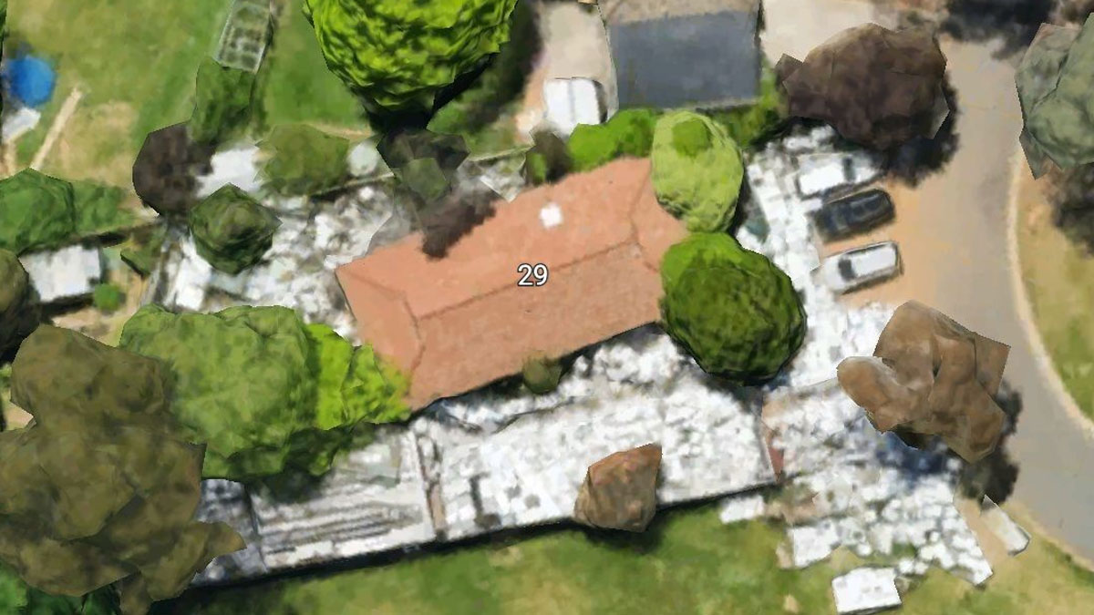
I would not of built a home here! This is the site of the old Norwich State Asylum, CT.
The founder had the highest praise for both the great community and the active team of admins and mods who help her out.
“We are a really friendly group and have an amazing admin team that works 24 hours around the clock to keep everything running smoothly. I would like to say 'thank you' to them all,” she said.
Go To Your Google Earth And Type Kent St. 44305 In Search And Click Street View You’ll See This Guy, Doing Whatever It Is He’s Doing
he's going to bury the body that's in that bag he's got on the bike... yup ,going to bury a body..
https://maps.app.goo.gl/GcU1hNpu41vT8npC9?g_st=ac
Load More Replies...It Looks Like Human Lips... In Sudan (12°22'13.32″n, 23°19'20.18″e). In My Opinion, It Resembles Lips
I swear the map said clittoris gulch is around here somewhere. Still can't find it for the life of me...
Old Tennessee State Prison. A Few Movies Have Been Filmed Here, Two Of Which Were Ernest Goes To Jail And The Green Mile
Look like an abandoned concentration camp. Not far from reality I guess.
I've visited Auschwitz when I was 19, and one thing I didn't expect was how absolute massive that place was, at least ten times bigger than what's seen on the photo here. Very similar eerie, downright oppressing vibe though.
Load More Replies...From Josie’s perspective, people enjoy Google Earth-related content, especially with a strange twist, because they are curious about the world they live in. Back when Josie first created the group, there weren’t many similar communities, which left an unfilled niche. "There weren't many Google Earth groups when I created my one," she told Bored Panda earlier.
According to the creator of the group, the best way to get started with using Google Earth is… get started! Use the program. Get used to it. Explore. Experiment. And just have fun. “I would just start looking at somewhere you have always wanted to visit, and maybe anywhere else that has piqued your curiosity and you have always wanted to see up close. Photo Sphere, a tool of Google Earth, is a great way to see photos people have taken and shared with the app.”
For Over 18 Years, The Google Earth App Has Been More Than A Tool—it's Become A Passion, With Thousands Of Hours Spent Exploring The Globe. Whenever I Watch Videos About Ancient Sites, I Can't Resist Diving Into The Satellite Imagery To Uncover Something Others Might Have Missed—and More Often Than Not, I Do
Man-Shaped Lake In Brazil. I Found It On Google Earth. 21°48'18"S 49°5'23"W
Just Me And My Cats Sat Minding Our Own Business On The Doorstep
Which of these anomalies intrigued you the most? Which pics did you think were the most aesthetic? Have you ever found anything bizarre on Google Earth or Google Maps? If so, what was it?
We’d love to hear from you! Grab a hot beverage, get cozy, and share your thoughts in the comments.
While The Artist Is Capturing The Scene Before Him, The Street Car’s Camera Captures Him At Work. Meanwhile, Some Passers-By Are Spotted Getting Legless In The Park
Discovered This Giant Human Today. -0.294722,-91.308333
Somewhere In Germany
New idea - play Chess using those miniature bottles of booze the airlines used to give out as pieces.
Nah, we don't do that here. We build towers with them ☝️ Turm-67978...949fdd.jpg
Found This Guy On Google Street View. Just Relaxing, Using His Phone Under A Pile Of Rocks
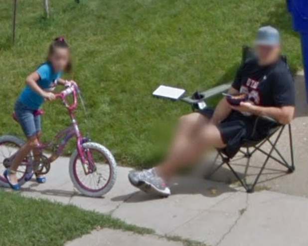
I think he‘s standing behind the pile of rocks. However i also thought he‘s taking a picture of a seal, but it‘s just a big rock 😂.
What Kind Of Ship...??
The bow of this oil tanker is likely constructed to pick up floating pipes that connect to a network of oil rigs and submerged storage so they can load offshore. https://www.google.com/search?q=knutsen%20oil%20tanker%20connecting%20to%20tower&udm=2&tbs=rimg:CdmE8RFcBl4AYdc2W-18EUhDsgIRCgIIABAAOgQIABAAVbwxvD7AAgDYAgHgAgA&client=ms-android-samsung-ss&cs=1&hl=nl&sa=X&ved=0CBIQuIIBahcKEwjQy_O275GLAxUAAAAAHQAAAAAQZg&biw=384&bih=784&dpr=2.81#vhid=MaKoi1gsF5DXlM&vssid=mosaic
My guess would be a cargo/container ship, currently without containers on it.
Sobotište, Slovakia, Europe 48.741756,17.374131
"Google maps is not the boss of me" 🛩️ 👨✈️ ✈️ 🤣😉
Load More Replies...Door Behind Mount Rushmore
oh, im feeling a bit down today. You made me want to look at their "get ready" medley. eta it kinda helped
Load More Replies...Trump will have his image carved there within the year - except twice the size of the others!
And all sane Americans will work together to dispose it into rubble.
Load More Replies...We all know about this. You can actually walk through to the nostrils
Guess The Country
If the lady's hand didn't give it away that this was Italy, OP's name (Antonio Pentrella) does LMAO. Nice one! :D
Clicked On A Random Spot In Bolivia And Found These Gorgeous Mountain Peaks. I Love Nature
Kempsey, Nsw Australia
On Lord Street, eh? Coincidence ? I think not......................
But Why Though? 39.459833, -76.184835
"A Russian Air Defense Squadron was defeated today by a sudden attack of Kudzu. Ukraine claims no responsibility."
Shouldn't that read "the US state of Georgia" claims no responsibility?
Load More Replies...So many airplane graveyards. The fuselages can be distributed and remade for housing.
Those appear to be various MiGs. Abandoned in Africa or Eastern Europe someplace?
The coordinates say northeast of Baltimore, Maryland, US. Phillips Airforce base? Aberdeen proving ground?
Load More Replies...In 2012, A Group Of Australian Researchers "Undiscovered" An Island The Size Of Manhattan In The South Pacific. A Mysterious Place Called Sandy Island Had Popped Up On Maps, Northwest Of New Caledonia. It Even Showed Up As A Black Polygon On Google Earth. But When Scientists Sailed There In November 2012, They Found Open Water Instead Of Solid Ground
Kinda looks like the shape of an aircraft carrier.... But probably too big
In The Middle Of Nowhere..37°20'51"N 113°45'42"W
It looks like a pumping station for a pipeline. There's a similar one to the east a few miles, and there's a cleared line between them
Why Is The Water Reservoir Completely Dry In The Palasaide?? Who Knows How Long It’s Been Empty For
Wikipedia: The reservoir gained notoriety in connection with the 2025 Palisades Fire. It was reported that the reservoir was drained due to concerns of contamination in February 2024 after a tear was found in its cover. According to the LADWP, the delay in repair was due to the lengthy time it takes to find a contractor under the Los Angeles city charter's competitive bidding process. On January 10, 2025, California Governor Gavin Newsom requested the Los Angeles Department of Water and Power and Los Angeles Department of Public Works to cooperate with a state investigation of the matter and conduct their own review
Leaving a mission-critical reservoir empty in the midst of fire season is the result of failed leadership at the top. Period. Problems with the 'competitive bidding process' (or whatever) is a just a symptom/byproduct.
Load More Replies...?????? (35.8900450, -117.6712762)
It's something on the Naval Weapons Center China Lake, California. Way out there.
A House In Canberra, Australia. White Goods Cover All Of The Front And Rear Yards. I Have Driven Past This A Few Times And Thought To Google It To See How Bad It Really Was
This is not far from me, they had been there for years, but looks like they've had a bit of clean up. https://maps.app.goo.gl/JvAqoBxmuutU6sZu5
Imagine your house is so messy that the neighbors talk about you behind your back. Now Google comes around and the whole world talks about you
Load More Replies...White goods refers to fridges, washing machines, dryers, etc. Appliances that traditionally have been white, although there's more variety these days.
Load More Replies...They definitely do not have an HOA. I feel for their neighbors.
Hoarding? But why all white?Maybe just because of distance of photo
Load More Replies...Phone Was Stolen In Las Vegas And This It Where The Last Know Location Pinged. I Have So Many Questions.....what The What??
That's a carpet shampooer. I can guarantee that the internal cleaning solution pump has crumbled into dust from using incompatible carpet cleaning chemicals. That's how all of these meet their end.
Load More Replies...Looks like they managed to steal most of a motel room and used a lawnmower as the getaway vehicle.
Predator?
This was my first thought (pic). "But there is only a plane..." Predator-p...0-1501.jpg
Found This On Google Street View Nearby Me
I know there is a reason for this, but right now, I'm just going to enjoy the creeeepy.
Just wait for the Swedes on BP and they can write about "Skogsrået" the mythical wood nymph that looks like a beautiful woman from the front but her back is either tree bark or looks like a hollowed out tree. She kills men. So this might be an action picture? 😉
Load More Replies...Navy Hovercrafts Near Norfolk, Va. These Can Carry Up To 70 Tons Of Payload (The Equivalent Of An M1 Abram’s Tank) Or Up To 180 Troops
That's ACU-4 (Assault Craft Unit 4) on NAB Little Creek. They are called LCACs (Landing Craft Air Cushion). That 180 troop carrying capacity is with a large box strapped to the deck.
My wife was with ACU-4, when I was at MARFORCOM. Those things in person are huge. She worked as a Load Master.
Load More Replies...Not Google Earth, But Found This In North Korea
Tried googling to click on it and the label is gone on the map, so I guess we will never know. Unless the sale was the entire building! /s
Load More Replies...Unsettling Street View Captures That Will Give You Chills
Found This Over Angel Island In The San Francisco Bay. Thought It Was A Neat Catch
I Was Roaming Around The North East Today And Came Accross Met Life Stadium With A Concert Set Up. 40°48'48.34"N 74° 4'23.80"W
Here's Levi's Stadium set up for Wrestemania. I'm somewhere in that mass of people gathered near the south entrance Screenshot...f1-png.jpg
My Old Car On Google Street View. Zoom In For Tiger Driver
Red Sea.. How It Really Looks
Pretty Cool Timing To Catch The Sat Image While The Drawbridge Is Up. Merrimack River Newburyport, Ma
But Did You Know About The Des Perez Pickle Jar?
What Is This ?
Got This Near Hartsfield-Jackson (33.6539049, -84.3633451)
There Is No Possible Explanation For This One – Just A Question. Why Water? Why A Mummy Costume? How Embarrassed Would The Little Kid In The Background Be By The Family's Antics? The Stairs Are Gone Now, But You Can See The Same View Of The Street Below
Beer Lover On A Flight Path, Greenville Wi
Looking To Move To Nc, But When I Zoomed In On These Folks With Google Street View I Decided Against This Particular Neighborhood Because Some People Are In Half. Or Maybe She’s A Half-Sister?
In Case Anyone Needs To Know Where It Is.....you Know, For A Friend. 38°04'12"N 117°13'34"W
Hope This Has Not Been Posted Before. 43°01'25"N 120°40'16"W - The Big "E", Almost In The Middle Of Nowhere In Central Oregon
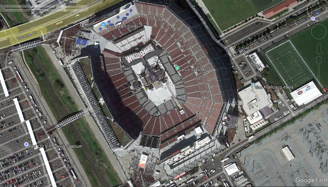
Nah, that's just the E from the map. How else would you recognise the State from space.. :-) Oregon-679...7a7045.jpg
You KNOW people had a "NO WAY!" moment and furiously searched for the rest of the letters.
Load More Replies...Welp. Jersey For Ya
Two Airplanes...the Guy Must Be A Big Deal. Iykyk
That's John Travolta's house - he has a commercial pilot's license. I believe the one on the right is his Boeing 737, and the one on the left is any one of a few of his smaller jets.
The whole neighborhood is set up like this. So you can park your planes right next to your house.
What Are These Circles? State Is Idaho If That Helps
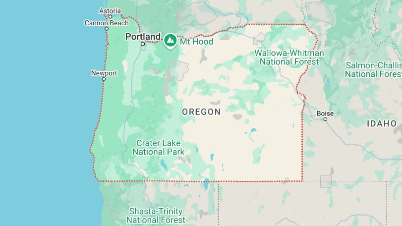
Irrigated crops. The circles are formed because the watering system base is in the center, and a very long sprinkling arm on large wheels rotates to water the crops. They're only obvious in places that are otherwise arid, but very green states like Michigan have them all over as well. They're just not as obvious in satellite views because the crops are essentially "green on green" - green crops surrounded by wild greenery. You'll particularly notice these obvious green circles all over the US west and particularly the southwest when the crops are on otherwise dry plains.
I see this whenever I fly to California. I like the PacMan one at the upper left.
Load More Replies...Those are irrigated areas, the water pipe is in the middle, and carried around it on a circling pipe.
This Spot Drop In Along The Mississippi River Has An Interesting Add-On. The Person Who Submitted It Doesn’t Show Any Other Submittals. This View Isn’t The Weird Part. Spin Around And See It. (38.1333785, -90.2615948)
When you do, the picture shows a really weird looking woman and an imposing drawbridge across the river, but the bridge is not there in aerial view.
This drop in using those coordinates land you on the side of a 2-lane highway. this-one-6...f6964c.jpg
First Time Poster, I Pass By This Quite Often On The Side Of 205 Freeway. Its Lit Up At Night
Found In Western Utah. No Idea What It Could Be
Cruciform shape. Maybe a former religious campground or race course?
Flying From Denver To Atlanta Today This Is Somewheres In Between Kansas And Oklahoma. What Is This?
As someone said ' W***y Wonka Chocolate (weed) Factory lol
Load More Replies...What Type Of River Is That? Google Earth Showing One Part Of River Green And Suddenly After A Line It Appears Black. Even Black Part Doesn't Show Any Relative Link To Black Part. Coordniates: 35°22'39"N 75°31'13"E
Because it's a stitched photo that was taken in two different seasons
Underwater Arrows In Lake Huron Right Off Of Sarnia Ontario. The Boats At The Top Give You An Idea Of The Scale. Taken At 3,000’ From An Airplane. No Idea What These Are For
Guess This Facility
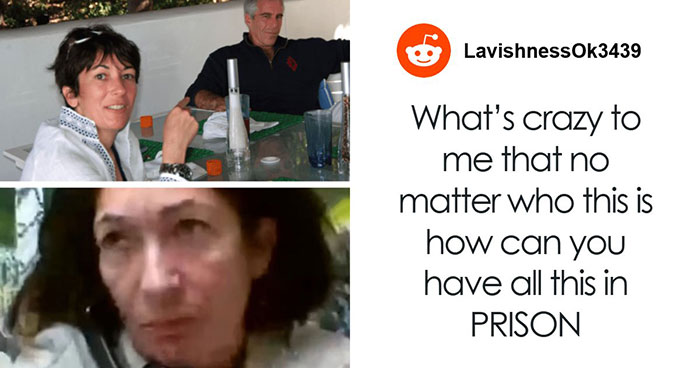
California City Correctional Facility: Built as a state prison, leased out to CoreCivic as a private-for profit prison, contract terminated, closed in 2024. Terrible place. Private prisons should be banned. If the state or the feds are going to lock someone up, it should be at a place run by the state. Using prisoners for profit is absolutely EVIL.
Check out Florence CO where the supermax prison is. On the other side of Arkansas River is Evans road. The whole road is jails, prisons, and correctional facilities.
Cypress, Tx
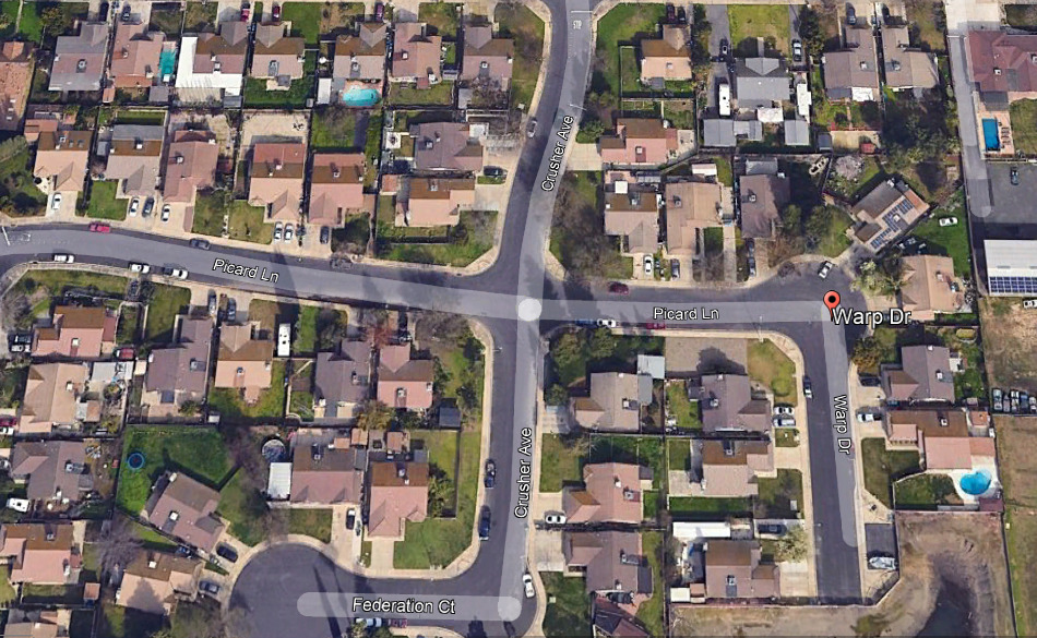
Streets named after Star Trek. Located in Turlock, California Screenshot...61-png.jpg
