Get Premium
Dark mode theme is available exclusively for premium users. Learn more about the benefits of subscribing.
No fees, cancel anytime.

 Dark Mode Ad-Free Browsing Unlimited Content
 Ad-Free Browsing Unlimited Content Dark Mode
Join 1.2 million Panda readers who get the best art, memes, and fun stories every week!
Learning can be fun; but if you don’t want to take my word for it, I will let today’s list do the talking.
Today, we’re focusing on geography and all sorts of maps that ought to bring some perspective into the way you view territories. Ranging from maps that show how many Switzerlands one Brazil can fit or how big Somalia is compared to the East Coast in the US, among other things, the list is a fascinating way to learn more about the world around us. So wait not a second longer, delve deeper into the fascinating maps, and enjoy the journey.
On the list below, you will also find Bored Panda’s interview with an Associate Professor in the Department of English Language and Literatures at the University of British Columbia and an expert in Medieval culture and maps, Dr. Robert Rouse, who was kind enough to answer a few of our questions.
This post may include affiliate links.
It’s safe to assume that few people’s hearts start beating faster when they think about maps. Unless you’re a geography enthusiast, you might not be overjoyed by the prospect of staring at one.
But in addition to a ‘regular one,’ which focuses on the territories of the countries of the world, there’s a plethora of other kinds of maps depicting all sorts of interesting information, which ought to awaken your curiosity. As this list will likely show, maps can be way more exciting than most people think!
Talking about why it is important to be familiar with maps—at least the one focused on countries’ territories—Dr. Robert Rouse of the University of British Columbia noted that if we don't know the world we live in, it’s hard to be an informed participant in politics or culture. “Maps provide us with a tool for displaying geographical (and other) information in an easily digested, readily readable format,” he said.
I’m dying in Dubbo away from my Pacific Ocean, I cannot imagine being this far from one 😭
The Flat Earth Society is disappointed in this scandalously wrong image /s/j
This is why Donald Trump keeps trying to buy Greenland BTW. The map makes him think it's bigger than it really is. Yes folks, the incoming POTUSA is an idiot who has no idea how maps work.
Talking about maps and perspective, Dr. Rouse pointed out that many people have little idea that maps are dependent on their technological perspective.
“The Mercator projection, which is the dominant mode of map-presentation that most people are familiar with, was developed for sea navigation (as it presents longitude and latitude on a familiar x-y grid pattern), and it dramatically distorts the size and area of many countries, exaggerating those towards the poles. This leads to many people underestimating the size of countries towards the equator, and overestimating those of the global north.”
That makes the amount of drives all over Australia I’ve done look so crazy next to looking at Europe and Africa, it’s cool to know I would have the enthusiasm to drive all over Africa’s continent 😂 (always wanted to see Sudan and Ethiopias ancient infrastructure and palace ruins)
The aforementioned Mercator projection (a cylindrical map projection) was presented in 1569 by the Flemish geographer and cartographer, Gerardus Mercator. As Dr. Rouse noted, it tends to distort the size of some countries, with a classic example, according to Science Direct, being Greenland—because of the projection, it appears to be much larger than it actually is relative to land masses near the equator. It also looks larger than Australia, for instance, when in reality, the land down under is roughly three and a half times larger than Greenland.
Oh so all those gifts from "Santa" really do come from the North Pole.
Even though maps focused on territory lines show exactly where one country ends and another begins, when it comes to cultural issues or such things as language and faith, it’s not all that clearcut.
Discussing how maps based on social or cultural issues can help people get a better idea of how certain cultures intertwine, Dr. Rouse suggested that most maps are presented using national boundaries, but most things—race, faith, cultural beliefs, and language—largely ignore these borders. In the expert’s opinion, it makes the world “a much messier, and more interesting, place.”
“We often have much more in common with people across the border than our politicians sometimes suggest,” he told Bored Panda.
While all sorts of unique maps are quite fun to analyze, according to the expert, there’s more to them than that. “They challenge us to think about the world differently, more complexly. And this is a good thing at a moment when politics seems to be becoming more insular, more nationalistic, in nature,” he said.
And as a Dutchman, I can say that the left map is similar to the projected map of 2100
You can make maps like this for most of the North American Continent.
This isn't exactly accurate. I can only speak about Canada, but we spell things the British way (colour instead of color etc) but the words we use and the way we speak is much closer to our American neighbors than to British English.
Relative size not actual size, BP. They are very much to scale. What are these, countries for ants?
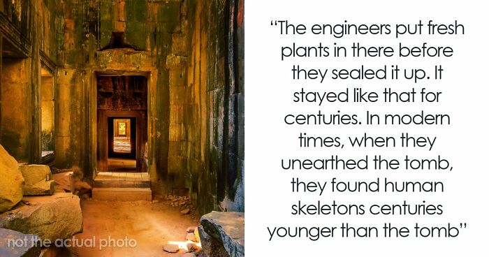
On September 22, 1979, a nuclear test is believed to have been conducted between Bouvet Island and the Prince Edward Islands. The test was detected by artificial satellites, which detected a brief but intense flash of light; radioactive dust was also detected by scientists in the Australian Antarctic Territory. No nation has ever admitted responsibility for the test, although it is widely believed that it was carried out by South Africa or Israel. The episode is known as the Vela incident.
Post Covid19, that has diminished a lot in Europe. We couldn't for 2 years, and most people rethought it. It's invasive to personal space, serves no purpose and makes people uncomfortable. ( think #METOO)So they simply dropped the habit.
No, hang on - what’s on the west side? I feel like this is relevant to prove their point.
Whereas you can drive for 149 minutes on the M6 and it feels like you’ve driven for 149 years and still haven’t got past Birmingham….
Be careful. This will confuse geography ignoramuses - you'll never convince them that Africa is not a country.
I know exactly which one I would choose to live in. Finnland is the happiest country in the world, and then there's Russia which treats its people as disposable. For no apparent reason. Look up Russian jails and Finnish jails on YouTube. The difference is both scary and enormous.
Istanbul is to Turkey as Constantinople is to the Byzantine Empire.
Load More Replies...I looked this up as I was skeptical, and yes, this is true. Chile is around 4300 km (2700 mi) long while the moon's diameter is around 3475 km (2150 mi). Estimates between different sites and data sources vary, but land around there.
If I were still teaching, I would cheerfully steal all these images and show them to my students. Especially the ones that depict the size of the continent of Africa. Too many people, even educated people, seem to think Africa is a country and small.
I was educated in Africa (eSwatini) and the first thing my geography teacher did was make us trace South Africa and Greenland from the globe, and try to fit it over the equivalent on Mercator.
Load More Replies...Great job!! I love these. Maybe sub-contract Thomas Pueyo to feed you maps.


 No fees, cancel anytime


")
")