Get Premium
Dark mode theme is available exclusively for premium users. Learn more about the benefits of subscribing.
No fees, cancel anytime.

 Dark Mode Ad-Free Browsing Unlimited Content
 Ad-Free Browsing Unlimited Content Dark Mode
Join 1.2 million Panda readers who get the best art, memes, and fun stories every week!
When most of us think about the word “data'' our eyes glaze over as a million Excel cells appear in our minds, putting us to sleep. So clever folks out there rolled up their sleeves and got to work, making visual depictions of data that help us better understand the world.
This online group shares various cool and interesting maps that help put all sorts of facts and figures into context. So get comfortable, prepare to brush up on some geography, and get to scrolling. Be sure to upvote your favorite posts and share your thoughts and observations in the comments section below.
This post may include affiliate links.
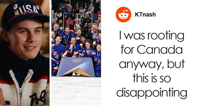
Fiji FTW! The Fijians are awesome! Even when they were cannibals, they still had great taste in people...
If you have ever taken a casual look at an average map of the world, you have no doubt been struck by the sheer size of Russia and, to a lesser extent, Canada. This does make sense, as these are the largest countries on the planet, however, did you know that a little feature of mapmaking called Mercator projection makes them look significantly larger than they really are?
This comes from the Flemish geographer and cartographer Gerardus Mercator, who created a “cylindrical” map to represent the world in 1569. After all, unless you are looking at a globe, most maps are drawn, painted, or printed on a rectangular surface. Imagine the tube-like maps pirates are always dragging around and you have a pretty good depiction of an early Mercator map.
Correct usage of football ⚽️ /s ☺️ not that I care about sports, just find the wordusage peculiar..
After all, the real landmasses on the planet, which are spherical, don’t translate 1-to-1 on a rectangular map. Certain sections end up stretched and, as a result, appear to be a lot larger than they actually are. Mercator chose to “focus” the map on the northern hemisphere, where locations closer to the “top” of the map would end up seeming larger. Hence Russia and Canada being absolutely gigantic on so many maps.
In fact, at the time, these maps were specifically created to aid in marine navigation. While it’s quite irrelevant to us, early seafarers could use a Mercator map to get a “straight” bearing when sailing to a new location. On a map that doesn’t use Mercator projection, the bearing would be a curve, representing the curve of the globe.
At least it started backfiring in Utah, banning the bible from schools. For content of murder, violence, sexual things etc.
English is mandatory here in Germany, additionally there are usually choices for french and spanish on top
That's not right, we have the moos (Alces alces). Not the red deer (Cervus elaphus)
This sort of map has simply stuck around for hundreds of years, leading many people to draw somewhat incorrect conclusions about the real size of things. We are lucky that Russia and Canada really are the two largest countries, so the distortions don’t seem as bad. Other examples of distortion are the similarity between the UK and Madagascar, despite the latter being nearly twice as large.
Even more comically, due to its northerly position, Alaska appears to be roughly the size of Australia, despite the fact that the land down under is almost five times larger. You can find an excellent gif depicting the presented and real size of various nations here.
Blue and yellow are reasonable, the rest seems overly complicated. Edit: Orange, not yellow ^^
And yet, men are treated as the default despite being a smaller percent of the population in the majority of countries.
Whoa... What's happening in nort Italy, Poland and around the Balkans? Why is it so bad there?
In regards to Alaska. A lot has to do with isolation: More isolated communities are harder to get police assistance and there are more crimes due to it. Drugs (a big factor), property theft, suicide, assault and murder happen very frequently. In the larger cities there is a lot of gang violence. There are also a lot of systemic socioeconomic disparities especially in indigenous communities.
The islands in Sweden are very very small but numerous. That's why they don't show up on most maps.
Nope, according to 'The Swedish Board of Agriculture', it's poultry meat (when not including sausages, ham and kassler). When you include them (and assuming they are 100% pork meat, pork is #1 by approximately 3,5x compared to fish.
These maps are misleading. They should have shown the point where it was reached and the temperature by zones. As it appears on the map it seems that all of Spain reached 47 degrees when it was in the south of Spain and probably in the northern half the temperatures were. By far lower
Thick Bushes, Thick Bushes of the South - Sorry, that made me giggle
Italy considers that the border to France is on top of the Monte Bianco/ Montblanc, but France disagrees
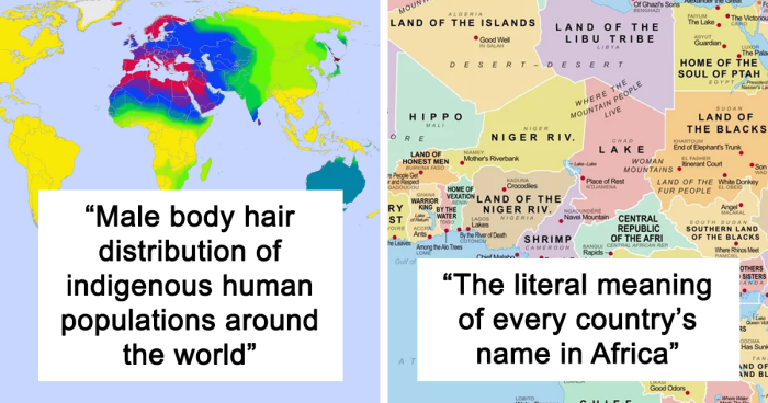
Fabre, Favre, Lefevre, Lefebvre and Faivre are all descended from the same root, the latin word "faber", which meant " craftsman" ... or ...Smith -))) Moreau means " little More" and was used for dark-haired people suspected ( rightly or wrongly) to be of Arab origins ( they did invade in the 9th century). Mostly, for long, common people didn't have a last name, and to tell apart people with the same first name, one used their occupation, physical particularities, or location (Dupuy means " from the hill", same as Delpech). I'm just à bir puzzled with " Wintersheim" , in , I think, Indre. ???
Spain has an exceptionally low birthrate. Lowest in Europe. So all of that is immigration? That doesn't seem right.
Is this because of economics, or lack of necessary heating equipment? Me also not knowing how cold it is in some of the southern countries here?
poor choice of color scheme...especially because "1.0" has different colors e.g. in Spain and Czech Republic. Would be easier to interpret if 1.0 was the center of a diverging color scheme
Not clear from that image whether they still claim the Falkland Islands.
Thanks to the decisions of "The Greens" (a party with enviromental protection as theme) we had to reactivate a few coal plants here in Germany in addition to buying energy from french nuclear plants and polish coal plants
Just like 4 women? (edit: maybe 6 - 7?) The rest men..? 🙈 https://www.reddit.com/media?url=https%3A%2F%2Fi.redd.it%2Fasked-midjourney-to-imagine-the-most-stereotypical-face-for-v0-5zrewdwk0rbb1.jpg%3Fs%3D7901a12e245f6b00a6e147ff0f806422445e1097
When I joined bp, I struggled in comprehending what I was looking at relating to these kind of maps...but when I finally got a 💡 inside my brain, I instantly fell in love with 'em...🗺️🌏🌎🌍🗺️
If you want more stuff like this I believe Visual Capitalist does a lot of them.
Load More Replies...When I joined bp, I struggled in comprehending what I was looking at relating to these kind of maps...but when I finally got a 💡 inside my brain, I instantly fell in love with 'em...🗺️🌏🌎🌍🗺️
If you want more stuff like this I believe Visual Capitalist does a lot of them.
Load More Replies...


 No fees, cancel anytime


")
 In Europe That Cant Speak Any Foreign Language")


")
")


")


")