Get Premium
Dark mode theme is available exclusively for premium users. Learn more about the benefits of subscribing.
No fees, cancel anytime.

 Dark Mode Ad-Free Browsing Unlimited Content
 Ad-Free Browsing Unlimited Content Dark Mode
Join 1.2 million Panda readers who get the best art, memes, and fun stories every week!
Scouring the corners of Google Earth and Maps has become an interesting way for people to explore the planet, and sometimes they come across the most unexpected finds. From random snapshots of humans to aerial images of bizarre landscapes, these discoveries reveal just how strange and fascinating the world we live in is. Some of the sights are hilarious, others might leave you scratching your head, but all of them are bound to captivate you. We’ve compiled this list of 46 photos that prove Google Earth and Maps are full of odd and extraordinary surprises.
This post may include affiliate links.
Just like the previous prison escapee, Google don't snitch!
Google Earth was downloaded over 100 million times in its first week after its much-anticipated launch in the early 2000s. It soon evolved into one of the world’s most popular discovery tools, allowing people to explore the planet from the comfort of their couches. Over the years, eagle-eyed users have spotted everything from puzzling shapes right down to hidden objects, all without having to leave home.
It’s clearly a group of Migs, next to a couple Russian helicopters, “hidden” under trees. These are at Phillips Army Airfield next to Aberdeen Proving Grounds. It looks like 3 mostly complete MiG-21s, and the middle fuselage sections of a 23 and 29. The helicopters look like a Mi-24 Hind and maybe an Mi-8. I wonder what the Army uses them for.
United Empire of America. Coming soon if the Tangerine Toddler has his way.
According to Google, this is likely a ghost image - The image shows an airplane that was captured in a satellite image on Google Maps. This is a common occurrence and not a sign of a plane crash. The plane is in flight and not submerged in water. The image is likely a satellite photo taken at a specific moment in time, and the plane's presence is a result of it flying over the area when the satellite image was captured.
They hurt its feelings.
Not useless! Useless Loop received the 2001 Banksia Award for Community Group Achievement and the 2001 Banksia Gold Award for its initiation of the Heirisson Prong Project in 1989 to protect and relocate the burrowing bettong, western barred bandicoot, and greater stick-nest rat, all endangered Australian mammals.
Tough to understand, but the writing seems to be a type of Portuguese Creole: It's likely a poem to the singer Bana, full of saudade (roughly translated as a nostalgic sad longing).
I see they're taking a cue from the gasoline industry...
they are bi-planes, AN-2 Colts. Awesome airplane, Russian in origin . Very rugged and easy to fly and maintain. In production from 1947 to 2001, over 18,000 built. North Korea uses it for special forces insertion because it can fly so low and slow radar has trouble picking it up.
People said goodbye to the old paper maps and street guides they had relied on for the longest time after Google Maps launched in 2005. What was first developed as a desktop app called Expedition soon became the map-making powerhouse we know today, offering not only directions, but also real-time traffic updates, street views, and satellite imagery.
Well, since it's on Google, would he then be Publíer Malone?
Found a weird thing in northern manitoba and I want to know if anyone know what this is 56.4340432, -94.2222389.
the Henday Land Electrode, a component of the Nelson River High Voltage Direct Current (HVDC) transmission system in Manitoba, Canada. The electrode is a grounding converter for the Limestone Power Generating Station, which belongs to Manitoba Hydro.
Take a look at the Malibu coastline. Now take a look on Google Maps / Google Earth to see what lurks underneath the waves on the ocean floor with no readily believable explanation. The attention, specifically to this location, is largely due to reports of a stadium-shaped "structure" about 2,000 feet underwater, widely known as Sycamore Knoll. Some refer to it as an anomaly while others believe is an alien base. It's believed to be between two-and-a-half and three-miles wide.
I thought this was BS, but it is weird that Google blurred it out back in April...
Whats funny is that the baby is looking towards the Google photographer vs the moms phone who probably has tried a few times to have the baby look at her...this was wholesome and the baby is definitely a shenanigan child.
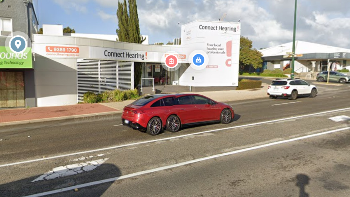
Cool list. Whatever happened to the Google Earth "flying car" in Perth, Australia from years ago?
I know the one. I haven't seen it around lately. At the time I thought it was a hang glider flying over the car park.
Load More Replies...Cool list. Whatever happened to the Google Earth "flying car" in Perth, Australia from years ago?
I know the one. I haven't seen it around lately. At the time I thought it was a hang glider flying over the car park.
Load More Replies...


 No fees, cancel anytime


")
")