You can look at the world from a lot of different perspectives, and maps are excellent tools that reflect this diversity of viewpoints.
Each cartographer chooses the story they want to tell, highlighting elements of geography, history, economy, and other areas to paint their own version of our planet.
Maybe it details countries and their borders, maybe it shows the spread of religions, or maybe it reveals the most popular soda drink in every region.
The social media project 'Terrible Maps' shares a whimsical and sometimes absurd approach to mapmaking, and it's full of funny takes you don't normally see in geography textbooks. Continue scrolling to see our hand-picked favorites!
More info: Book | Facebook | Instagram | X
This post may include affiliate links.
Detailed Doggo Map


A Map Of Ancient Grease

A Map Of Europe Drawn From Memory

Oklahoma If It Was Used To Express Feelings

A World Map Centered On Antarctica

Australia vs. Austria, Just For Clarity

How Long Is Chile

According to Wikipedia "Chile stretches over 4,300 km (2,670 mi) north to south" According to https://www.converttobananas.com/ 4300km equates to 24,157,303.370787 bananas. You're welcome.
Wow didn't know such a website existed! You made my day, well actually my night since I should be sleeping rn
Load More Replies...Why put Ireland upside down? and Belgium.... I don't even know what way is up?
They put the longer side of each country to adjust them to the size of Chile.
Load More Replies...Do one for the width (like compare with the LA strip connecting Downtown to San Pedro Screenshot...bda138.png 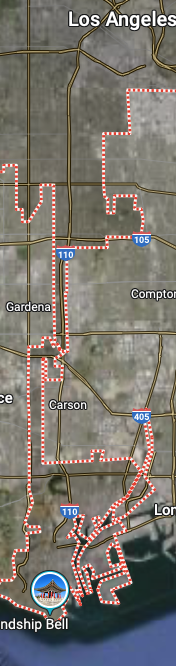
So apparently South Americans will use anything but the metric system too?
Foutland

Being A Bad Neighbour

The reason why the border is shaped that way is the path of a river. That’s exactly the same reason why the power plant was built in this place (cooling water needed). And this nuclear power plant produces electricity for Belgium (and Luxembourg, and Germany). I guess you’d have to be an ignorant idiot to call that being a crappy neighbour.
Yolklahoma

Fatalities From Texting And Driving In 1960

As An Austrian: So Good

A Map Of The Earth After A Sea Level Rise Of 480m... Just Because

Australia.. Explained To Americans

I get Melbourne being NY-ish & Sydney-Brisbane as California. But how is Canberra similar to Jersey?
Fun Fact: Cyprus Is Just A More Aerodynamic Version Of The USA


Egypt Is Smaller Than The United States, Russia And China Combined

Map Of All The Churches In Poland

Olive Oil Europe vs. Butter Europe

Map Of European Countries Playing Football

It looks more like Europe is about to step on a bleached turd.


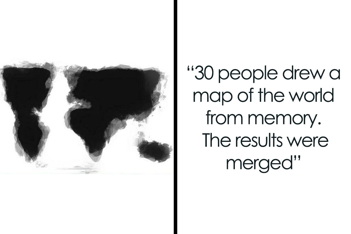
30 People Drew A Map Of The World From Memory. The Results Were Merged

Map Of Europe But With The Wrong Font Size

Minimalistic World Map

A Map Of Poland's Subways

Most Popular Soda In Every European Country. The Scots Won't Be Happy With This

US States But The First Letter Is Missing

A Map Of Europe With The Naughty Bits Censored

Countries That Bill Gates Is Richer Than Are Marked With A Picture Of Bill Gates Smiling

Most Popular Words In Online Dating Profiles, By State

A Map Of The World Without Islands

After the next Brexit, when Britain voted to leave both UN and the planet.
Note: this post originally had 53 images. It’s been shortened to the top 30 images based on user votes.


('Oliver Twist' - film, 1968, if anyone's interested) Oliver-twi...c414d7.gif 
('Oliver Twist' - film, 1968, if anyone's interested) Oliver-twi...c414d7.gif
