ADVERTISEMENT

As technology moves at the speed of light, we often hear that "there's an app for that." And while maps have been around for centuries, they've evolved to be more than just about navigation, or showing us where a place a place is. Nowadays, there are countless other maps that flip the script on how we see geography, culture, and history. Some challenge our assumptions. Others highlight hidden truths. Many teach us something we might not have known before. With the amount of maps available on paper and online, one could easily argue that "there's a map for that."

There's an online community dedicated to sharing the most interesting maps around. r/MapPorn has clocked up an impressive 5.9 million followers. They share fascinating and thought-provoking data in map form. Bored Panda has put together some of the most perspective-changing maps we could find on the page. Keep scrolling for a different kind of trip around the world and don't forget to upvote your favorites. We also spoke to cartophile and creator of Brilliant Maps, Ian Wright to learn more about how maps have evolved.

You might be old enough to remember the days we would keep a paper map in the cubby of the car. Many were massive, and needed to be carefully unfolded in order for us to see the whole picture, and figure out how to get from Point A to Point B. Of course, there were, and still are map books. A little less bulky but still require some "map-reading" and navigation skill on your part, or you risk ending up on the opposite side of where you're meant to be.

The kids of today will never know the struggles, or joy, of holding an old, worn-out paper map in their hands while setting off on a great adventure. Nowadays, your car or mobile phone speaks to you. As confident as a co-driver during the Dakar Rally. H**l, nowadays, you'll even know whether there's traffic, an accident, or a roadblock on your route. And exactly where it is, how to avoid it, how long the new route will take based on your traveling speed.

ADVERTISEMENT
RELATED:
    #2

    The Great Wall Of China vs. Europe

    Map illustrating the Great Wall of China stretched across Europe with a red outline on a blue continental map.

    ThunderWolf Report

    #3

    Bathymetry Of Great Lakes

    3D map showing topographic depth of the Great Lakes, a detailed map to expand your knowledge of the world.

    multi_tasker01 Report

    Add photo comments
    POST
    x6rkq946s6
    Community Member
    1 month ago DotsCreated by potrace 1.15, written by Peter Selinger 2001-2017

    This one is actually pretty cool. Bonus points for not being political.

    View more commentsArrow down menu

    The world has indeed come a long way since our ancestors carved maps on clay tablets. Researchers say the earliest known maps date back to ancient Babylon around 600 BCE. And back then, they were based on the belief that the earth was flat, and one wrong step could send you tumbling off into oblivion.

    Today, we have people like Ian Wright. He's the founder of Brilliant Maps, one of the most popular cartographic sites on the internet. We were thrilled when the self-professed cartophile agreed to have a chat with Bored Panda about the importance of maps, and whether they serve a purpose in the digital age.

    ADVERTISEMENT
    ADVERTISEMENT

    "Maps are important not only because they help us navigate and give us a sense of place in the world but they can be the starting point of new adventures," Wright told us. "Plus, they can also be used to explain the world in a very easy to understand way."

    #4

    What Antarctica Looks Like Without Ice

    Topographic map showing detailed terrain and islands, one of the 80 maps to expand your knowledge of the world.

    vladgrinch Report

    #5

    70% Of Canadians Lives In 3 Areas

    Map showing 70% of Canada's population living in colored areas, highlighting key regions to expand your knowledge of the world.

    rayg10 Report

    Add photo comments
    POST
    Soosh_tr
    Community Member
    1 month ago DotsCreated by potrace 1.15, written by Peter Selinger 2001-2017

    main reason for the red zone is the heart, communication route and beautiful St-Lawrence river and the Great Lakes 🐳🌊🚢

    View more commentsArrow down menu
    #6

    How Many Hours Do Europeans Really Work?

    Map showing average weekly working hours in Europe by country in 2024, highlighting regional differences in actual work hours.

    Galixiiss1546 Report

    ADVERTISEMENT

    Wright's interest in maps was sparked when he decided to walk London's Tube map - above ground. He then started looking more into what makes the Tube map unique. And later started sharing various maps he’d found on Twitter, the former bluebird app now known as “X”. Today, his account has more than 129,000 followers and over 16,000 posts. He’s branched out and built a successful business around his passion for maps.

    "I love maps because I think they're one of the best ways to learn about the world," Wright told Bored Panda during our interview. "They remain one of the best tools to explain the world to people." And the proof is in the list of maps you see while scrolling through this list.

    ADVERTISEMENT
    #7

    H*******t Victims By Country

    Map showing Holocaust victims by country in Europe with numbers, part of maps to expand your knowledge of the world.

    vladgrinch Report

    #8

    Doctor’s That Can’t Refuse An Abortion In Europe

    Map highlighting European countries where doctors cannot refuse an abortion, expanding knowledge of the world through detailed maps.

    LuckyTraveler88 Report

    Add photo comments
    POST
    quentariel
    Community Member
    1 month ago (edited) DotsCreated by potrace 1.15, written by Peter Selinger 2001-2017

    In Finland (where abortions are legal) it is ofter a clause in a work contract if you work in hospitals that deal with pregnancies. Many bigger hospitals don't hire people refusing to do abortions. But the whole culture around it is less traumatic than in many other places. Free healthcare allows people to found out their pregnancies in really early stages, when the abortion can be done with a medicine. There's no protestors, and women get support no matter what they choose. Besides, because s*x-ed and readily available contaceptives, accidental pregnancies or teen pregnancies aren't too common.

    View more commentsArrow down menu
    ADVERTISEMENT
    #9

    Africa In 10 Million Years

    Satellite view of Africa showing geographical changes projected over 10 million years for maps to expand knowledge of the world.

    LuckyTraveler88 Report

    Add photo comments
    POST
    Lyone Fein
    Community Member
    1 month ago DotsCreated by potrace 1.15, written by Peter Selinger 2001-2017

    The split is startling. But otoh, the Sahara might actually be greener starting from its southern edge.

    View more commentsArrow down menu

    "Maps can tell us lots of things beyond just where things are! They can show us the weather patterns, like where storms might hit or sunny spots to visit," says the cartophile. "Maps can also track fun things like animal migrations, popular foods in different regions, and historical events. Pretty much, if you can imagine it, there's probably a map for it!"

    #10

    British English vs. American English: What’s Taught In Schools?

    World map showing American English and British English regions, highlighting language distribution across countries.

    vladgrinch Report

    ADVERTISEMENT
    #11

    The Hippie Trail, Where Western Hippies Travelled Throughout The 60s And 70s Usually To Consume D***s And Spiritual Awakening(Oc)

    Map showing the Hippie Trail route across Europe and Asia highlighting key cities and travel paths on a world knowledge map.

    Wally_Squash Report

    Add photo comments
    POST
    Ace
    Community Member
    1 month ago (edited) DotsCreated by potrace 1.15, written by Peter Selinger 2001-2017

    I always thought Morocco was a (another) prime destination. #We're on the road to Marrakesh,

    View more commentsArrow down menu
    ADVERTISEMENT
    #12

    People Who Believe The Government Is Hiding A Cure To Cancer

    Map showing the percentage of people in Europe who believe the government is hiding a cure to cancer with color-coded regions.

    LuckyTraveler88 Report

    Add photo comments
    POST
    Mel in Georgia
    Community Member
    Premium
    1 month ago DotsCreated by potrace 1.15, written by Peter Selinger 2001-2017

    There is no one cure for cancer. Cancer is many, many things and has many, many different causes.

    View more commentsArrow down menu

    Bored Panda asked Wright whether he thinks paper maps still have a place in the world. Or are they about to be dead and gone? "Interestingly, I was just at a conference and paper maps are still going strong," he told us. "But the key for them in the long term is to create something personal and unique to the map buyer. So while generic paper maps might be on the way out, personalised ones are likely to be with us for the long haul."

    #13

    Size Comparison Of European Microstates

    Maps showing detailed layouts of small countries including Andorra, Malta, San Marino, Liechtenstein, Monaco, and Vatican City.

    Xhiw_ Report

    #14

    Countries Where More People Died Than Were Born During The Year 2024

    World map highlighting countries in red, illustrating a unique perspective to expand knowledge with educational maps.

    OppositeRock4217 Report

    ADVERTISEMENT
    ADVERTISEMENT
    #15

    Freedom Of Press Rankings In Europe

    Press freedom map of Europe 2025 showing global rankings and color-coded countries from good to very serious.

    LuckyTraveler88 Report

    Wright is best known as the founder of the Brilliant Maps site and the subsequent book. But his journey is just beginning. "Beyond continuing to run BrilliantMaps.com, I also have two more books in the works," he revealed. "The first is a sequel to my best-seller Brilliant Maps: An Atlas For Curious Minds and the second will be a geography based trivia game."

    #16

    Who Wants To Join Eu The Most?

    Map showing support percentages for joining the EU in various countries, part of maps to expand your knowledge of the world.

    SquareFroggo Report

    Add photo comments
    POST
    Nope
    Community Member
    1 month ago DotsCreated by potrace 1.15, written by Peter Selinger 2001-2017

    Just love how the Swiss are perpetually like "Yeah, no thanks. Carry on."

    View more commentsArrow down menu
    #17

    With Almost Every Vote Counted, Every State Shifted Toward The Republican Party

    US map showing margin change by state from 2020 with color gradient highlighting voting shifts for knowledge expansion.

    EverestMaher Report

    Add photo comments
    POST
    Mel in Georgia
    Community Member
    Premium
    1 month ago DotsCreated by potrace 1.15, written by Peter Selinger 2001-2017

    People just want "different from what things are." The incumbent party tends to suffer because of this. Also - the Republican party is very, very good at creating anger and fear.

    View more commentsArrow down menu
    ADVERTISEMENT
    #18

    A British Propaganda Poster Against Russia From The 1800's

    Vintage political map of Europe featuring an octopus symbolizing Russia’s influence, part of 80 maps to expand world knowledge.

    monsterduckorgun Report

    ADVERTISEMENT

    Nowadays, every second kid has an iPad, they're caught up in the latest series or game, their parents use GPS and the world is hurtling towards a fully digital realm. So how do we keep children interested in maps? What do we do to ensure their survival?

    "I think making it about them and their interests is key. Have a kid who loves dinosaurs, show them a map of Pangea," suggests Wright. "A kid who loves space, show them a map of the moon. A kid who loves Harry Potter show them a map of wizarding schools."

    #19

    68% Of Gaza Declared To Be Off-Limits To Gazans As Israel Expands Its Domination Of The Territory

    Map showing evacuation areas and no-go zones in Gaza, highlighting territorial changes and conflict impact for world knowledge expansion.

    Joshistotle Report

    Add photo comments
    POST
    Nathaniel He/Him Cis-Het
    Community Member
    1 month ago DotsCreated by potrace 1.15, written by Peter Selinger 2001-2017

    F**k Hamas, but I support the Palestinians that are being forced out of their homes and off their land. I support peace and an end to violence. Israel needs to calm the f**k down.

    View more commentsArrow down menu
    #20

    Here's Where W**d Is Legal In The Us

    Map showing marijuana legalization status by state in the US, part of 80 maps to expand your knowledge of the world.

    USAFacts Report

    Add photo comments
    POST
    blixten1982
    Community Member
    1 month ago DotsCreated by potrace 1.15, written by Peter Selinger 2001-2017

    Just come up to Canada, weed is legal and sold in stores to anyone over 18 nation wide.

    View more commentsArrow down menu
    ADVERTISEMENT
    #21

    U.S. Counties Where Life Expectancy Is Below That Of North Korea

    Map of US counties with life expectancy below 72.6 years, highlighting areas to expand your knowledge of the world.

    BufordTeeJustice Report

    Add photo comments
    POST
    Heir of Durin
    Community Member
    1 month ago DotsCreated by potrace 1.15, written by Peter Selinger 2001-2017

    I feel like a lot of these areas are reservations. :/ I know for sure the area in AZ and NM is the Navajo reservation.

    View more commentsArrow down menu
    #22

    Where Did Jesus’s Disciples Go After This Picture:

    Painting of the Last Supper above a map showing apostles’ itineraries and spread of Christianity in the ancient world.

    Sad_Bug8421 Report

    Add photo comments
    POST
    Nathaniel He/Him Cis-Het
    Community Member
    1 month ago DotsCreated by potrace 1.15, written by Peter Selinger 2001-2017

    Joseph off to the UK. He wants to get tanked up on stella with the lads down at 'spoons and then go for a ruby.

    View more commentsArrow down menu
    ADVERTISEMENT
    #23

    Map Showing Countries Within Range Of Israel's Nuclear Missiles (Jericho III)

    World map highlighting a specific shaded region spanning multiple continents in an informative geographic map.

    Ok_Somewhere9687 Report

    #24

    How Many Cities Over 1 Million People Does Each Country Have?

    World map showing the number of cities with over 1 million people in different countries to expand knowledge.

    Joergen-the-second Report

    ADVERTISEMENT
    #25

    A Look At The Oldest Universities In Continuous Operation Across Europe

    Map showing oldest universities in continuous operation across Europe, North Africa, and the Middle East to expand your knowledge of the world

    marbellamarvel Report

    #26

    Religion And Literacy Rate In Nigeria

    Map showing religion distribution and literacy rate in Nigeria, highlighting key data to expand your knowledge of the world.

    ellatino230 Report

    ADVERTISEMENT
    #27

    United States Counties Where Selling Of Alcohol Is Completely Prohibited

    Map of United States counties where the selling of alcohol is completely prohibited for world knowledge expansion.

    dphayteeyl Report

    Add photo comments
    POST
    Khavrinen
    Community Member
    1 month ago DotsCreated by potrace 1.15, written by Peter Selinger 2001-2017

    Fun fact: one of those counties that prohibit the sale of alcohol is Moore County, Tennessee, where Jack Daniels whiskey is distilled. It's made there, but they can't sell it there.

    View more commentsArrow down menu
    ADVERTISEMENT
    #29

    UK's Largest Immigrant Communities By Region

    Map showing UK’s largest immigrant communities by region with Poland and India highlighted, from 80 maps to expand knowledge of the world.

    vladgrinch Report

    Add photo comments
    POST
    Lazy Panda 2
    Community Member
    1 month ago DotsCreated by potrace 1.15, written by Peter Selinger 2001-2017

    There's two main waves of Polish immigration into the uk. The first after WW2, in recognition of Poland's support to the UK during that time. The second is after Poland joined the EU and the UK was still a member.

    View more commentsArrow down menu
    #30

    Vast Stretches Of The World Are Now Below The Replacement Rate. You Will Probably Live To See Humanity's Population Peak

    World map showing 2024 global total fertility rates with color-coded regions for low, medium, and high fertility.

    AmericaGreatness1776 Report

    Add photo comments
    POST
    Nathaniel He/Him Cis-Het
    Community Member
    1 month ago DotsCreated by potrace 1.15, written by Peter Selinger 2001-2017

    I mean, given the world's population and the scarcity of resources like water, this is a good thing?

    View more commentsArrow down menu
    ADVERTISEMENT
    #31

    European Countries By The Exact Shade Of Blue In Their Flag

    Map of European countries by the exact shade of blue in their flags, shown in various blue tones to expand world knowledge.

    xMusa24 Report

    ADVERTISEMENT
    #34

    Which Of The 10 Largest Cities By Population Is Closest To You?

    World map highlighting major cities with flight paths and geographic boundaries to expand knowledge of the world.

    Organic_Product_2464 Report

    Add photo comments
    POST
    Multa Nocte
    Community Member
    1 month ago DotsCreated by potrace 1.15, written by Peter Selinger 2001-2017

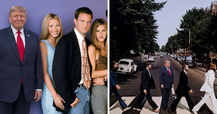
    Don't show this to Trump or he will move everyone in the US to NYC just to show Mexico!

    View more commentsArrow down menu
    ADVERTISEMENT
    #35

    Countries That Lost Forces Supporting U.S. Forces In Afghanistan

    World map highlighting countries that lost forces supporting U.S. in Afghanistan, illustrating global military involvement on maps.

    Brilliant-Nerve12 Report

    #36

    Christianity In The Us By County

    Map of Christianity distribution in the US by county showing Protestantism, Catholicism, and Mormonism for expanding world knowledge.

    zevalways Report

    Add photo comments
    POST
    April Pickett
    Community Member
    1 month ago DotsCreated by potrace 1.15, written by Peter Selinger 2001-2017

    It's all of those Baptists in the South. There is a Baptist church for every belief, even if you're not Baptist.

    View more commentsArrow down menu
    ADVERTISEMENT
    #37

    Area Of N**i Germany Control On The Day Of Their Official Surrender

    Map showing Allied counteroffensive and German-occupied areas in Europe during the Second World War in 1943-45

    marbellamarvel Report

    #38

    Country Names Compared To English

    Map showing European nation names that are extremely different compared to English, highlighting unique country names for world knowledge expansion.

    LuckyTraveler88 Report

    Add photo comments
    POST
    CF
    Community Member
    1 month ago DotsCreated by potrace 1.15, written by Peter Selinger 2001-2017

    I find it odd that countries are not called by what they are in their national (official or not) language

    View more commentsArrow down menu
    ADVERTISEMENT
    #39

    Us States With A Ban On Construction Of Nuclear Power Plants

    Map highlighting US states with statewide moratoriums, part of maps to expand your knowledge of the world.

    IsleFoxale Report

    Add photo comments
    POST
    NJ P
    Community Member
    1 month ago DotsCreated by potrace 1.15, written by Peter Selinger 2001-2017

    As an engineer, nuclear power is the most efficient and greatest producer of energy. Problems lie with waste disposal and the corruption and excessive bureaucracy regarding plant construction.

    View more commentsArrow down menu
    #40

    Homeowners That Lock Their Doors In The U.S

    Map showing the percent of homeowners by state who always lock their door, part of 80 maps to expand knowledge of the world

    LuckyTraveler88 Report

    Add photo comments
    POST
    x6rkq946s6
    Community Member
    1 month ago DotsCreated by potrace 1.15, written by Peter Selinger 2001-2017

    I’m in one of the 80% states, live in a middle class/lower middle class neighborhood bordering on some lower class areas. I’ve lived here for over 20 years and almost never lock my door. The number of times I’ve been the victim of a break-in, robbery or crime? Never. Not once. Crime rates are sensationalized to sell guns. I don’t own a gun and I feel safe. My neighbors and I are safer than society and the media would have us believe.

    View more commentsArrow down menu
    ADVERTISEMENT
    #41

    Is It Legal To Drink Coffee While Driving?

    Map showing legality of drinking coffee while driving in Europe, highlighting countries with yes or no answers from world maps.

    vladgrinch Report

    Add photo comments
    POST
    mlef30
    Community Member
    3 weeks ago (edited) DotsCreated by potrace 1.15, written by Peter Selinger 2001-2017

    When I was very young, I thought, "drinking and driving" meant drinking ANYTHING while driving. I made my dad pull over to finish his coffee one morning because I was convinced he was breaking the law and would go to jail. Later, I learned the truth and felt silly. Now I feel vindicated! Granted, I live in the US, but still!! I"m gonna go tell my dad I saved him.

    View more commentsArrow down menu
    #42

    Currencies In Europe

    Map showing where to find which currencies in Europe as of February 2025, highlighting Euro and other currencies regions.

    throwitintheair22 Report

    Add photo comments
    POST
    Rich Black
    Community Member
    4 weeks ago DotsCreated by potrace 1.15, written by Peter Selinger 2001-2017

    True fact - the Russian ruble has fallen to "one half cent" since Putin invaded Ukraine. Unlucky to be living off a pension there . . .

    View more commentsArrow down menu
    ADVERTISEMENT
    See Also on Bored Panda
    #43

    The Most Common Blood Types In Europe, By Country

    Map showing the most common blood types in Europe, highlighting A+ and O+ distribution for expanding knowledge of the world.

    quindiassomigli Report

    #44

    Median Home Size In USA Compared To Parts Of Europe

    Map showing average home sizes in square feet across the United States and Europe with color-coded regions.

    BufordTeeJustice Report

    Add photo comments
    POST
    XenoMurph
    Community Member
    1 month ago DotsCreated by potrace 1.15, written by Peter Selinger 2001-2017

    And when a strong wind blows, the homes go from 2000 sq feet to 50,000 sq feet.

    View more commentsArrow down menu
    ADVERTISEMENT
    See Also on Bored Panda
    #45

    Germany's Largest Immigrant Communities By Region

    Map showing Germany's largest immigrant communities by region with Turkey, Ukraine, and Syria represented by country flags.

    vladgrinch Report

    Add photo comments
    POST
    Rali Meyer
    Community Member
    1 month ago DotsCreated by potrace 1.15, written by Peter Selinger 2001-2017

    Well, people from Turkey came as early as the 60s (without checking), to help in factories. And percentages would help

    View more commentsArrow down menu
    ADVERTISEMENT
    See Also on Bored Panda
    #47

    If “Did Not Vote” Was A Party In The 2021 Canadian Federal Election

    Map showing voter turnout percentages by province in Canada’s 2021 Federal Election highlighting did not vote data.

    manitoba94 Report

    Add photo comments
    POST
    Verena
    Community Member
    1 month ago DotsCreated by potrace 1.15, written by Peter Selinger 2001-2017

    Sad. I wonder if these people would get upset if no elections would be held anymore.

    View more commentsArrow down menu
    ADVERTISEMENT
    See Also on Bored Panda
    #48

    Deception Island Near Antarctica Have Such A Straight Eastern Coast?

    Satellite view of Deception Island, an Antarctic caldera, shown in one of the maps to expand your knowledge of the world.

    marbellamarvel Report

    #49

    Which City (In Your Country) Are You Most Ashamed Of?

    Map highlighting cities in Europe people feel ashamed of, expanding knowledge of the world with geographical insights.

    SquareFroggo Report

    Add photo comments
    POST
    Nope
    Community Member
    1 month ago DotsCreated by potrace 1.15, written by Peter Selinger 2001-2017

    This is the most humorous of this entire list. Everyone in those cities are nodding "Yep, fair play".

    View more commentsArrow down menu
    #50

    Hawaii On The Same Scale As The U.k

    Map showing the true scale of Hawaii compared to the United Kingdom, highlighting major Hawaiian locations across the UK.

    whiterafter Report

    Add photo comments
    POST
    Continue reading with Bored Panda Premium
    Unlimited content
    Ad-free browsing
    Dark mode
    ADVERTISEMENT
    See Also on Bored Panda
    #51

    Second Largest Religion In European Countries

    Map of the second largest religion in European countries showing Islam, Christianity, Judaism and other faiths for knowledge expansion.

    vladgrinch Report

    #52

    24 Hours Of Flights Between Europe And The Us

    Map showing 24-hour air traffic routes between Europe and the United States to expand your knowledge of the world.

    vladgrinch Report

    Add photo comments
    POST
    #53

    The Dictators Overtrown By The Arab Spring

    Map showing dictators overthrown by the Arab Spring with highlighted countries and leader portraits on a world knowledge map.

    Individual-Sun-9426 Report

    Add photo comments
    POST
    pelemele
    Community Member
    1 month ago DotsCreated by potrace 1.15, written by Peter Selinger 2001-2017

    The fall of Bashar al-Assad has nothing to do with the Arab Spring.

    View more commentsArrow down menu
    #54

    Drug Overdose Deaths Across Europe

    Map showing drug-related deaths per 1 million population aged 15-64 across European countries with data points visualized by size.

    Trustrup Report

    Add photo comments
    POST
    CF
    Community Member
    1 month ago DotsCreated by potrace 1.15, written by Peter Selinger 2001-2017

    This one needs more info, like a date range (unless I'm missing it). Also I question the results- do some countries report OD d e a t h s differently?

    View more commentsArrow down menu
    #55

    2024 Democracy Situation In Europe

    Map of Europe showing the 2024 democracy situation with scores illustrating levels on democracy index for knowledge expansion.

    quindiassomigli Report

    Add photo comments
    POST
    x6rkq946s6
    Community Member
    1 month ago DotsCreated by potrace 1.15, written by Peter Selinger 2001-2017

    Let’s do this to compare the US in 2020 (before 9/11, COVID and Trump) compared to now.

    View more commentsArrow down menu
    #56

    First 5 Countries To Recognize The U.S

    Map showing the first five countries to recognize the United States highlighted for expanding knowledge of the world.

    LuckyTraveler88 Report

    Add photo comments
    POST
    Multa Nocte
    Community Member
    1 month ago DotsCreated by potrace 1.15, written by Peter Selinger 2001-2017

    And what did France get in return? When the US is mad at France they change their name for fried potatoes to "Freedom fries" instead of "French fries." Which is ironic because they are Belgian anyway.

    View more commentsArrow down menu
    #57

    Countries Adolf Hitler Visited

    Map showing countries in Europe visited by Adolf Hitler highlighted in red to expand your knowledge of the world.

    dphayteeyl Report

    Add photo comments
    POST
    x6rkq946s6
    Community Member
    1 month ago (edited) DotsCreated by potrace 1.15, written by Peter Selinger 2001-2017

    I was expecting there this time be a side-by-side with countries Trump visited

    View more commentsArrow down menu
    #58

    Use Of Dinner vs. Tea vs. Supper In The UK

    Map showing British and Irish dialect regions for evening meals, highlighting tea, dinner, and supper preferences across the UK and Ireland.

    vladgrinch Report

    Add photo comments
    POST
    Nathaniel He/Him Cis-Het
    Community Member
    1 month ago DotsCreated by potrace 1.15, written by Peter Selinger 2001-2017

    We have dinner at lunch time and tea at dinner time. Also do not confuse tea time with tea time. Tea time we have a cup of tea, and at tea time we sit down for a meal.

    View more commentsArrow down menu
    #60

    Where Good Friday Is A Public Holiday

    World map highlighting various countries in red to expand knowledge of the world with informative global maps.

    OppositeRock4217 Report

    See Also on Bored Panda
    #61

    Pastoral Visits Of Pope Francis

    Map showing pastoral visits of Pope Francis worldwide with countries highlighted based on number of visits for expanding knowledge of the world.

    AdIcy4323 Report

    #62

    Eligible Electors By Region For The Next Pope

    Colorful pie chart showing world regions with numbers representing maps to expand your knowledge of the world.

    APrimitiveMartian Report

    #63

    Countries That Skip Labor Day (1st Of May)

    Map showing countries that skip Labor Day on May 1st, highlighting regions with no public holiday in world maps collection.

    vladgrinch Report

    Add photo comments
    POST
    Robert Beveridge
    Community Member
    1 month ago DotsCreated by potrace 1.15, written by Peter Selinger 2001-2017

    To be fair, America does have a holiday called Labor Day, it just falls in a different month.

    View more commentsArrow down menu
    #64

    Poland At It’s Maximum Extent Compared To Its Borders Today

    Historical and modern map comparison of Poland highlighting territorial changes to expand knowledge of the world.

    vladgrinch Report

    Add photo comments
    POST
    John Dilligaf
    Community Member
    1 month ago DotsCreated by potrace 1.15, written by Peter Selinger 2001-2017

    I think this "maximum extent" is the Polish-Lithuanian Commonwealth, not Poland by itself.

    View more commentsArrow down menu
    #65

    Map Of Airstrike Locations By India

    Map showing key locations and conflict zones in the India Pakistan conflict with airstrike sites and artillery fire details.

    multi_tasker01 Report

    Add photo comments
    POST
    Lyone Fein
    Community Member
    1 month ago DotsCreated by potrace 1.15, written by Peter Selinger 2001-2017

    I didn’t realize that Amritsar was so close to the Line of Control. It is The Most major Sikh shrine.

    View more commentsArrow down menu
    #66

    The World According To Apple Look Around (Apple Maps Street View)

    Abstract world map showing outlines of continents and countries in blue on a dark background for maps to expand knowledge.

    lukstez Report

    Add photo comments
    POST
    Toothless Feline
    Community Member
    1 month ago DotsCreated by potrace 1.15, written by Peter Selinger 2001-2017

    Interesting how only several major cities and California’s tech coast are covered in the US, while Google has Street View coverage in pretty much every county seat and many smaller towns throughout the US.

    View more commentsArrow down menu
    #67

    Canadian Election Projections: January 2025 vs. The Actual Outcome

    Two Canada federal projections maps showing seat distributions for political parties in 2025, highlighting regional differences.

    CBowdidge Report

    Add photo comments
    POST
    Michael MacKinnon
    Community Member
    1 month ago DotsCreated by potrace 1.15, written by Peter Selinger 2001-2017

    The New Democrat (social democrats) vote broke hard for keeping the Conservative leader out.

    View more commentsArrow down menu
    #68

    The First Time Each European Country's Leader Took Office

    Map of Europe showing data by year, using color codes to expand your knowledge of the world through detailed maps.

    Prudent_Comedian_479 Report

    #69

    USA Murder Rate By State

    Heat map showing the murder rate by state in 2024 with color gradient indicating homicide rates across the USA.

    Pale_Consideration87 Report

    Add photo comments
    POST
    Multa Nocte
    Community Member
    1 month ago DotsCreated by potrace 1.15, written by Peter Selinger 2001-2017

    Latest figures I could find - Wyoming murder rate for 2022 was 2.6, for Vermont it was 3.4, and for New Hampshire it was 1.8.

    View more commentsArrow down menu
    #70

    New York's Top 10 Speeders And Where They Have Received Tickets

    Map showing New York’s top 10 super speeders with colored dots marking frequent violation locations in 2024.

    Kooker321 Report

    Add photo comments
    POST
    Multa Nocte
    Community Member
    1 month ago DotsCreated by potrace 1.15, written by Peter Selinger 2001-2017

    I am curious as to why people are allowed to continue driving after this many violations.

    View more commentsArrow down menu
    See Also on Bored Panda
    #71

    Israel Travel Advisory Map

    Map of Europe showing Israel’s travel advice categorized by safe, potential threat, avoid, and prohibited zones.

    AdIcy4323 Report

    Add photo comments
    POST
    Nope
    Community Member
    1 month ago DotsCreated by potrace 1.15, written by Peter Selinger 2001-2017

    An absolute shame this advise needs to be given. No one should be unsafe anywhere.

    View more commentsArrow down menu
    #72

    What Do You Call The Vehicle That Hauls Freight?

    Map of the United States showing regional terms for large trucks including semi, tractor trailer, and eighteen-wheeler.

    PoopKing6969 Report

    Add photo comments
    POST
    Nathaniel He/Him Cis-Het
    Community Member
    1 month ago DotsCreated by potrace 1.15, written by Peter Selinger 2001-2017

    In the UK we like to distinguish by colour. Red lorry, yellow lorry, red lorry...

    View more commentsArrow down menu
    #73

    Most Common Immigrant In Italy🇮🇹

    Map of Italy filled with various world flags within its regions, designed to expand your knowledge of the world.

    Jaded_Landscape_6481 Report

    Add photo comments
    POST
    Nope
    Community Member
    1 month ago DotsCreated by potrace 1.15, written by Peter Selinger 2001-2017

    The key/legend in this one was particularly useful :-p

    View more commentsArrow down menu
    #75

    Special Envoy Keith Kellogg Proposed To "Divide" Ukraine, Like Berlin After World War II

    Map showing British, French, Ukrainian, and Russian forces in post-conflict Ukraine with demilitarized zone and key cities marked

    TackleDry1732 Report

    Add photo comments
    POST
    x6rkq946s6
    Community Member
    1 month ago DotsCreated by potrace 1.15, written by Peter Selinger 2001-2017

    Why should Ukraine be divided? Russia should be divided up instead

    View more commentsArrow down menu
    #76

    A 'Purple Map' Of The Us Presidential Elections, 2024

    US 2024 presidential election map showing purple America with counties colored by political affiliation using red, blue, and purple shades.

    yechengs Report

    Add photo comments
    POST
    LakotaWolf (she/her)
    Community Member
    1 month ago DotsCreated by potrace 1.15, written by Peter Selinger 2001-2017

    I live in a very "red" city in an otherwise extremely "blue" area (Southern California.) It's quite trippy. My city isn't grotesquely "red" (like, there aren't hordes of people walking around on the streets in MAGA hats with guns yelling "MURICA!!!!") - but that's probably because it's a beach town and being TOO extreme would be bad for tourism XD

    View more commentsArrow down menu
    #77

    Delmar Divide (St. Louis Mo)

    Map showing home value, income, education, and racial demographics in two adjacent neighborhoods for world knowledge expansion.

    DrDMango Report

    Add photo comments
    POST
    Mel in Georgia
    Community Member
    Premium
    1 month ago DotsCreated by potrace 1.15, written by Peter Selinger 2001-2017

    There are so many lines like this in the US ... especially in the South.

    View more commentsArrow down menu
    #78

    Update: States Where P**nhub Will Be Blocking Access As Of January 1, 2025

    US map highlighting states that have banned a specific website, illustrating digital restrictions with clear red and white color coding.

    DizzyDentist22 Report

    Add photo comments
    POST
    Multa Nocte
    Community Member
    1 month ago (edited) DotsCreated by potrace 1.15, written by Peter Selinger 2001-2017

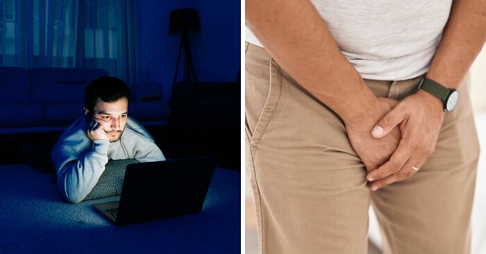
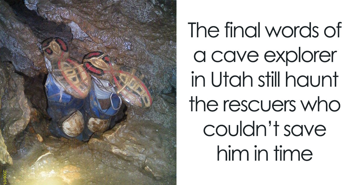
    Too bad for Utah, who has one of the highest (if not the highest) rates of po‍rn consumption in the US, despite (or due to) all the Mormons.

    View more commentsArrow down menu
    #79

    Last Time Each European Country Was Invaded And By Who

    Two Europe maps showing years of last invasion by country and most recent invader, illustrating historical and geopolitical knowledge.

    vladgrinch Report

    Add photo comments
    POST
    Ace
    Community Member
    1 month ago (edited) DotsCreated by potrace 1.15, written by Peter Selinger 2001-2017

    The Argentinian invasion of the Falkland Islands was not an invasion of Britain as such, The islands were (are) a British Overseas Territory, which is distinct from actually being a part of Britain. So scrub 1982, replace with 1066 and the Normans

    View more commentsArrow down menu
    #80

    How Every County Voted Over The Last 3 Elections

    US map showing how every county voted in the last three elections with colorful political voting patterns.

    Mission-Guidance4782 Report

    Add photo comments
    POST
    x6rkq946s6
    Community Member
    1 month ago DotsCreated by potrace 1.15, written by Peter Selinger 2001-2017

    Considering Clinton won the popular vote, as did Biden, I’m calling bullsh!t on this one.
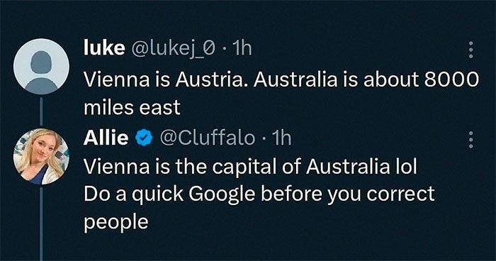
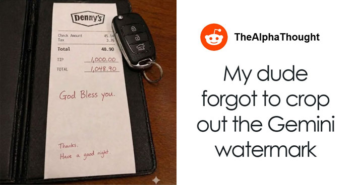
    View more commentsArrow down menu