Get Premium
Dark mode theme is available exclusively for premium users. Learn more about the benefits of subscribing.
No fees, cancel anytime.

 Dark Mode Ad-Free Browsing Unlimited Content
 Ad-Free Browsing Unlimited Content Dark Mode
Join 1.2 million Panda readers who get the best art, memes, and fun stories every week!
From massive fires to super typhoons, natural disasters wreak havoc on the world, often changing history forever. While we usually get to see the devastation these events leave behind on TV and sometimes firsthand, it’s rare to see how they look from space. Thanks to satellites and astronauts, we’re now able to see these historic moments from a new perspective, reminding us just how powerful nature and humankind are. Get ready to explore 14 stunning photos of the Earth’s most historic events seen from space.
This post may include affiliate links.
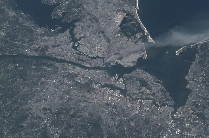
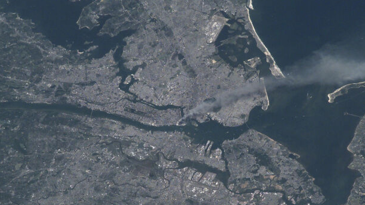
Close to 3,000 people lost their lives on September 11, 2001, when the Twin Towers of the World Trade Center in New York were struck by hijacked aircraft. This image captured the devastation from space, with smoke seen drifting across the city on the morning of the tragic event.
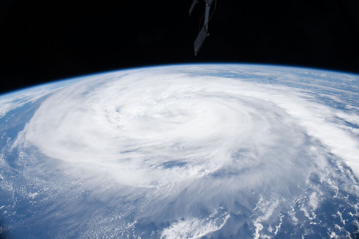
This Category 5 super typhoon, also known as Odette, ravaged the Philippines in December 2021, leaving massive destruction in its path. With winds reaching speeds of over 96 mph and widespread flooding, hundreds of thousands of people were displaced from their homes. The catastrophic typhoon was visible from space as a massive spiral over the Philippine Sea.
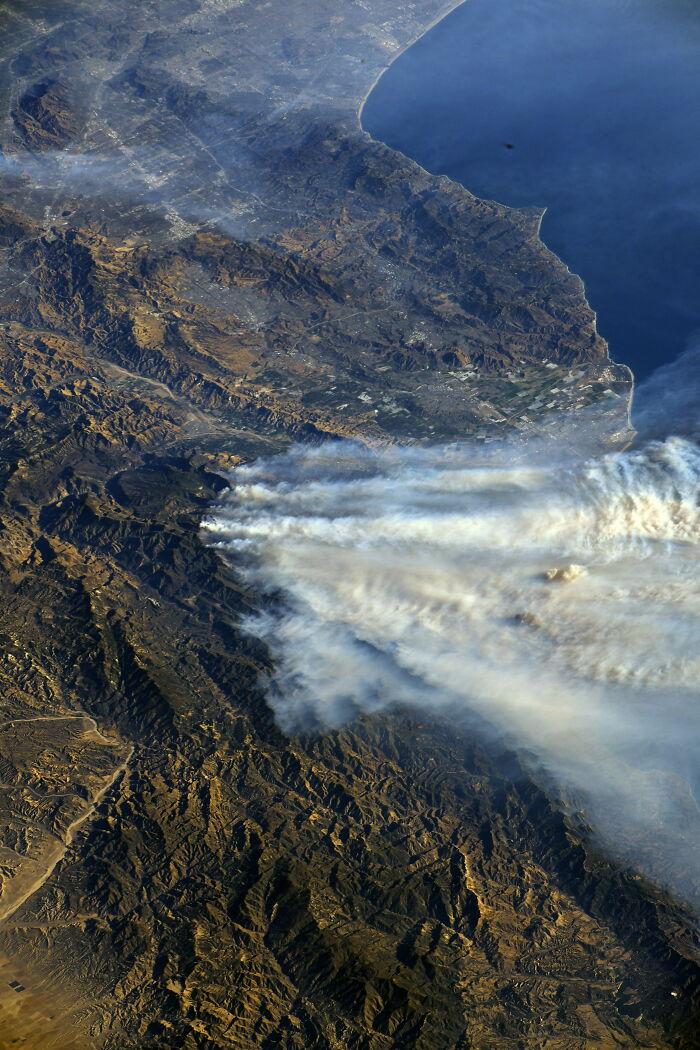
With strong winds and dry conditions, what began as the Lachman Fire in the Pacific Palisades soon turned into a series of 14 wildfires. Out of these 14, the Eaton and Palisades fires were the most destructive, making it onto the list of the most devastating fires in California’s history. Satellite imagery from space captured the thick smoke drifting across the city towards the Pacific Ocean.
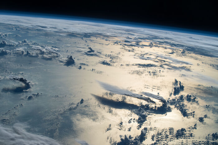
This striking image of thunderstorms over the Philippine Sea was captured from space in August 2016. Unfortunately, with strong wind shear being so common, storms often stretch across the atmosphere and develop into typhoons. Interestingly, the 2016 Pacific typhoon season recorded 26 named storms, with 14 of them affecting the Philippines region.
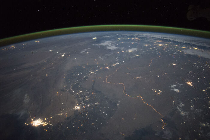
It might come as a surprise that city lights are actually visible from space. This stunning satellite image not only shows the glowing city lights in India and Pakistan, but also captures the border between the two countries. Clearly visible as the long orange thread, the border is lit up by around 150,000 floodlights.
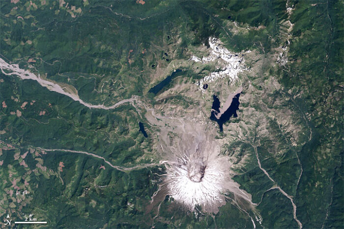
Often described as the most disastrous volcanic eruption in U.S. history, the 1980 eruption of Mount St. Helens caused massive damage. Visible from space as a thick cloud of ash across the Pacific Northwest region of the country, the blast alone claimed the lives of 57 people and destroyed 200 homes.
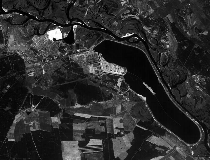
This image was captured by the French SPOT satellite a few days after the devastating blast at the Chernobyl Nuclear Power Plant in April 1986. Considered one of the earliest space-based records of a nuclear disaster, the image was used to assess the spread of radiation and damage caused.
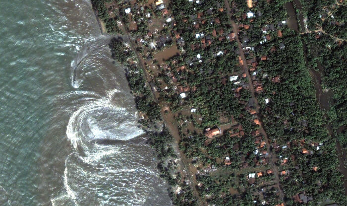
The 2004 Indian Ocean tsunami has been dubbed one of the most devastating natural disasters ever recorded, with over 228,000 fatalities across 15 countries. One of the hardest hit was Sri Lanka, and this image taken from space captures the moment the massive waves reached the coast of Kalutara, Sri Lanka.
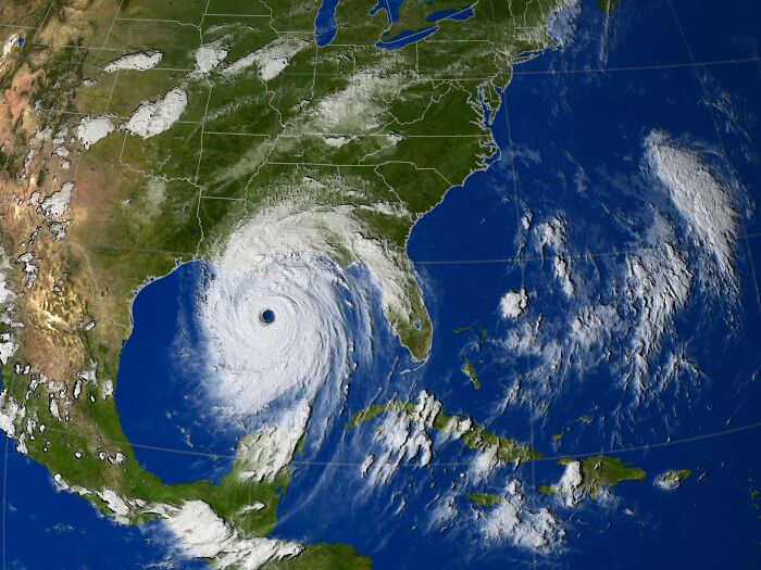
Hurricane Katrina was one of the most disastrous tropical cyclones in U.S. history, reaching Category 5 strength and causing massive flooding in New Orleans. This satellite image captured the hurricane’s spiral stretching across the Gulf of Mexico and over the coastline, and sadly, more than 1,300 people perished because of it.
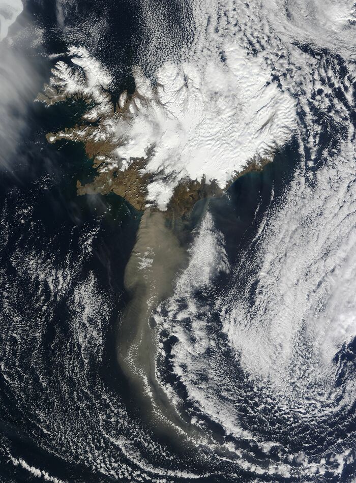
Although this eruption was considered moderate in size, it caused about 20 countries in Europe to ground all air travel due to the amount of volcanic particles in the atmosphere. This satellite image captured from space shows the large amount of ash drifting over the continent and the Atlantic Ocean.
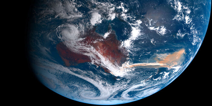
The 2019/2020 bushfire season in Australia was one of the most catastrophic fire seasons in the country’s history. This image captured the thick smoke and iron-rich dust sweeping east across the South Pacific, with the latter triggering the spread of large red algal blooms that could be seen from space.
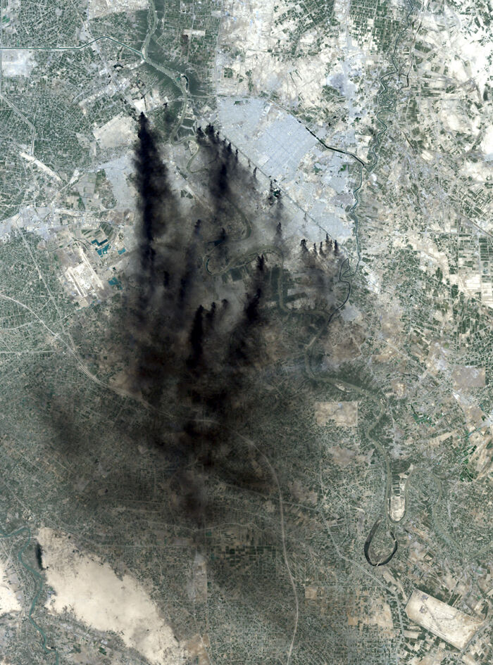
This NASA Landsat 7 image, captured during the Iraq War, depicts the dark smoke over Baghdad on April 2, 2003. Most would assume the smoke was coming from the aerial blasts that were taking place in Iraq, but it was actually coming from oil-filled trenches set alight by the country’s forces. Interestingly, they used this strategy as a defensive tactic against coalition aircraft.
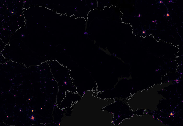
This haunting satellite image of Ukraine in near-total darkness was taken at the height of the Russo-Ukrainian conflict in late 2022. Russian airstrikes on the country’s power grid caused widespread outages, with cities such as Kyiv, Kharkiv, and Odesa being affected the most by the energy instability.
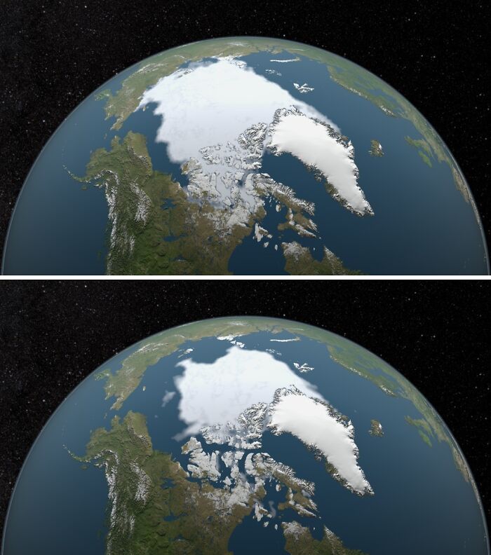
Unfortunately, global warming is transforming the Arctic at a faster rate than any other region on Earth. These satellite images of the Arctic Sea ice, taken in 1979 and 2015, reveal the dramatic decline in the size of the ice caps due to rising temperatures.



































 No fees, cancel anytime