Get Premium
Dark mode theme is available exclusively for premium users. Learn more about the benefits of subscribing.
No fees, cancel anytime.

 Dark Mode Ad-Free Browsing Unlimited Content

 Ad-Free Browsing Unlimited Content Dark Mode

Join 1.2 million Panda readers who get the best art, memes, and fun stories every week!
Astronauts have a name for the feeling that hits them when they see Earth from space for the first time: the overview effect. The term was coined by writer Frank White in 1987 and describes a sudden rush of awe at how fragile and connected the planet looks from above. There are no borders, just swirling clouds, glowing oceans and landscapes painted in colors you’d never notice from the ground. Most of us will never leave the atmosphere, but thanks to the satellites circling overhead, we can get a pretty good taste of that view.
The Instagram page Galaxies regularly shares these breathtaking perspectives, and its feed reads like a gallery of Earth’s most astonishing corners. A desert in Africa stares back like a giant eye. A volcano in New Zealand sits inside a forest so perfectly round it looks drawn with a compass. A Pacific island is shaped like a heart, a Nevada lake swirls like spilled paint, and a weather satellite catches the Moon peeking over Earth’s horizon. Some scenes look so surreal they could pass for another planet entirely.
We’ve gathered some of the most striking images from the page, along with the fascinating stories behind them, from ancient pyramids and Ice Age lakes to restless volcanoes that are still reshaping the map. Scroll down for a fresh look at the world we call home, and tell us which view made your jaw drop.
More info: Instagram
This post may include affiliate links.
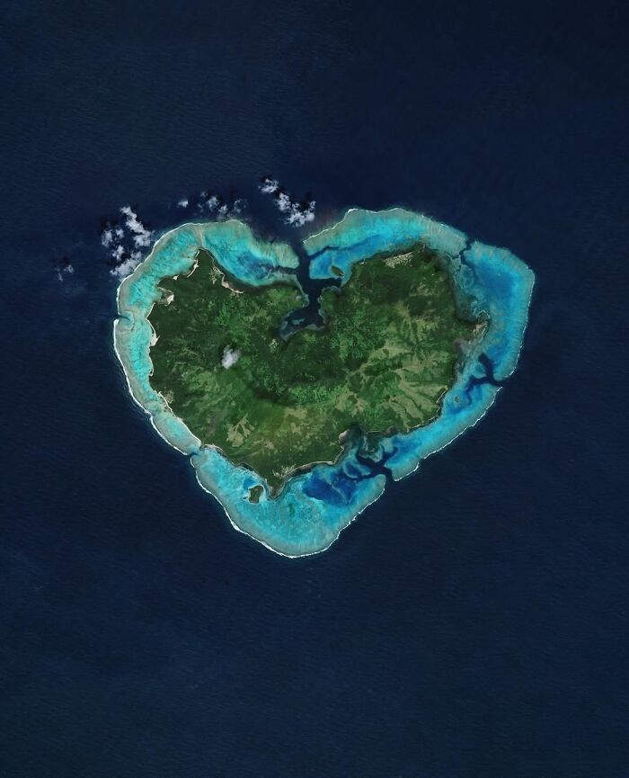
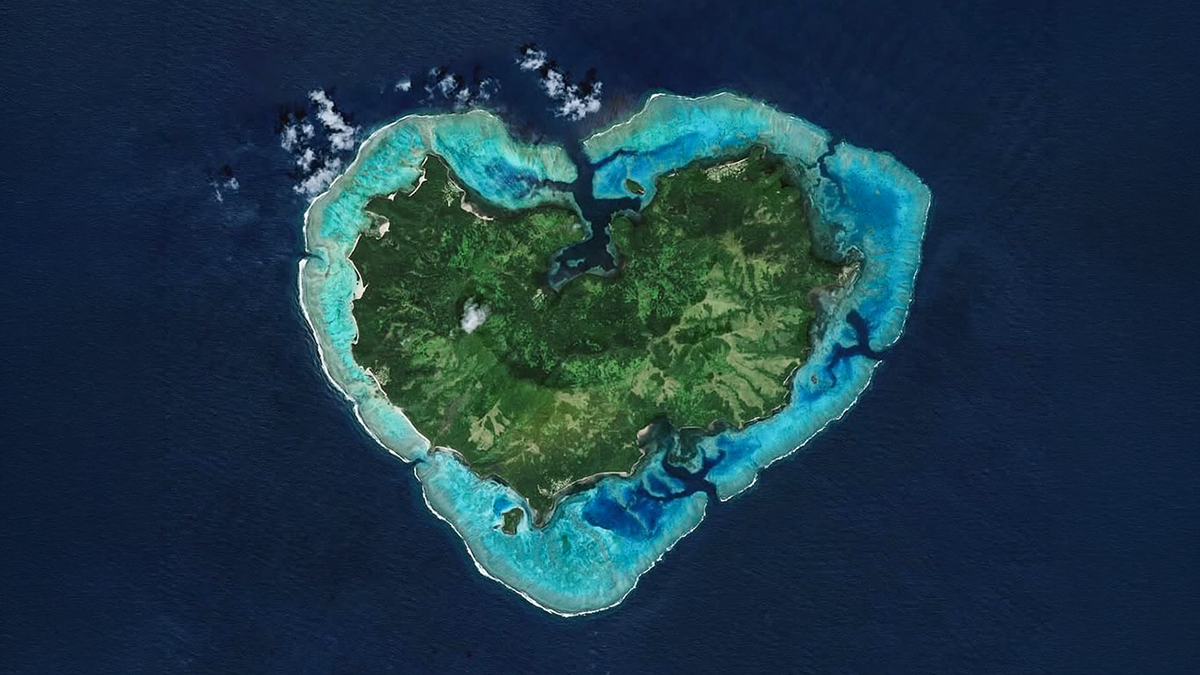
This heart-shaped island is Matuku, a remote volcanic island in Fiji’s Lau archipelago, ringed by a turquoise coral reef. It covers about 22 square miles (57 km²), rises to 1,263 feet (385 m), and is home to around 500 people living in seven villages along the coast. The dent at the top of the heart is the remnant of an ancient volcanic crater, now a sheltered bay that boats reach through a pass in the reef. Islanders have also set up traditional “tabu” zones where fishing is banned, to keep their reef healthy.
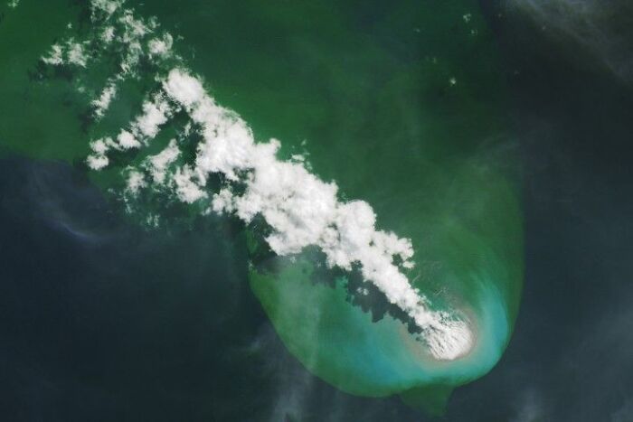
On May 8, 2026, a swarm of small earthquakes beneath the Bismarck Sea signaled that a hidden volcano was waking up. Within a day, satellites spotted steam plumes rising almost 2 miles (3 km) above the water, about 80 miles (125 km) southeast of Manus Island. Scientists believe the eruption is coming from the Titan Ridge, a name proposed by local residents. In this Landsat 8 image from June 4, a plume of steam rises from the sea while discolored water spreads around the vent. Freshly erupted pumice, still hot enough to show up in infrared images, floats near its base. That pumice drifted for miles and piled up several feet deep on the shores of nearby islands, blocking boats and cutting off access to fishing, food and medical services. Scientists watched closely in case the eruption built a brand-new island, but none had been confirmed as of summer 2026.
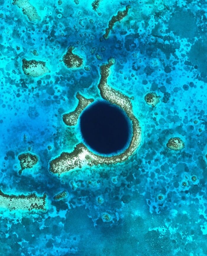
This almost perfect circle of deep blue sits in the middle of Lighthouse Reef, about 43 miles (70 km) off the coast of Belize. It’s roughly 1,000 feet (300 m) wide and 410 feet (125 m) deep, and it began as a dry limestone cave. When the Ice Age ended and sea levels rose, the cave flooded and its roof collapsed, leaving behind stalactites that divers can still see today. Jacques Cousteau made it world-famous in 1971, calling it one of the best dive sites on the planet.
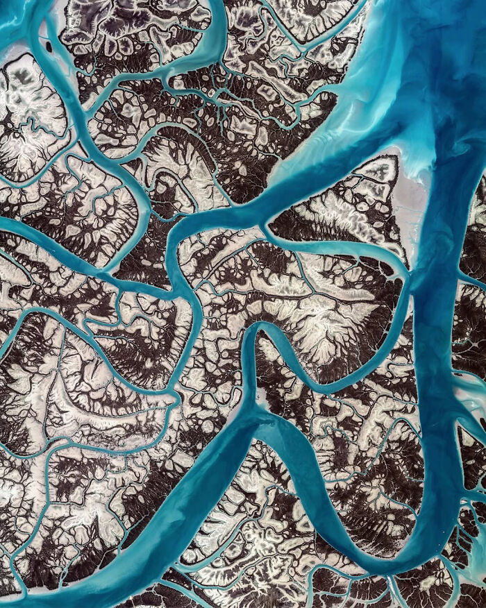
These branching blue channels wind through the Hara Forest, a mangrove forest between Qeshm Island and the Iranian mainland in the Persian Gulf, and the largest mangrove ecosystem on the gulf’s coast. It’s dominated by the grey mangrove, Avicennia marina, a tree named after the Persian scholar Avicenna. The tree survives in salty water by getting rid of excess salt through its leaves. The area has been protected since 1972 and attracts flamingos, pelicans and herons, while green sea turtles come here to feed.
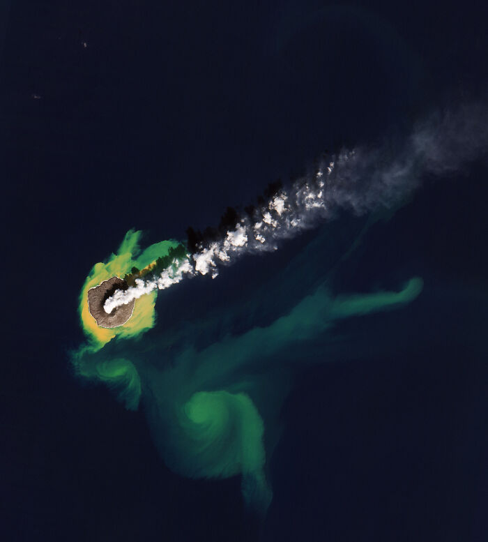
About 620 miles (1,000 km) south of Tokyo, Nishinoshima is a volcanic island that keeps building itself. Until the 1970s, only a tiny sliver of it showed above the waves, around 2,300 feet (700 m) long. Then a series of eruptions, especially one that began in 2013, poured out so much lava that by 2021 the island measured about 1.4 miles (2.3 km) across. The yellow and green swirls around it are seawater stained by volcanic minerals, gases and stirred-up seafloor sediment, which ocean currents carry for miles.
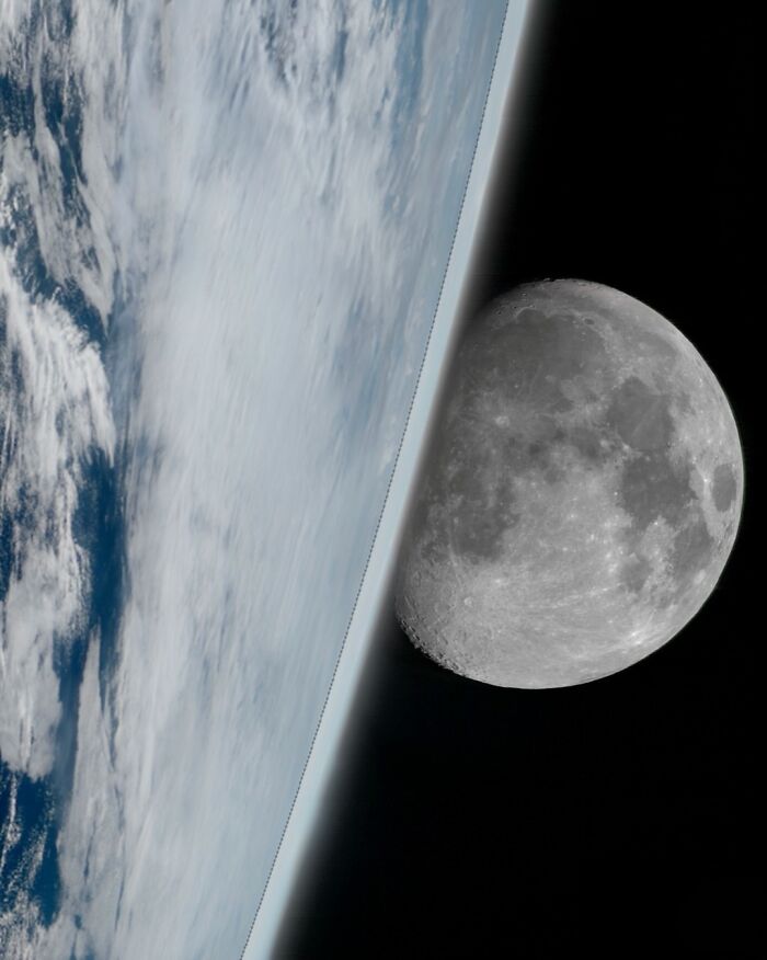
Japan’s Himawari-9 weather satellite captured this striking view on October 23, 2026, at 00:20 UTC. The satellite orbits about 22,000 miles (35,800 km) above the equator and photographs the entire planet every 10 minutes, so now and then the Moon drifts into the edge of its frame. Here, the thin blue glow of Earth’s atmosphere and its swirling clouds sit right beside the Moon’s cratered surface. The Moon only looks this close, though: it’s actually around 238,000 miles (384,000 km) from Earth.
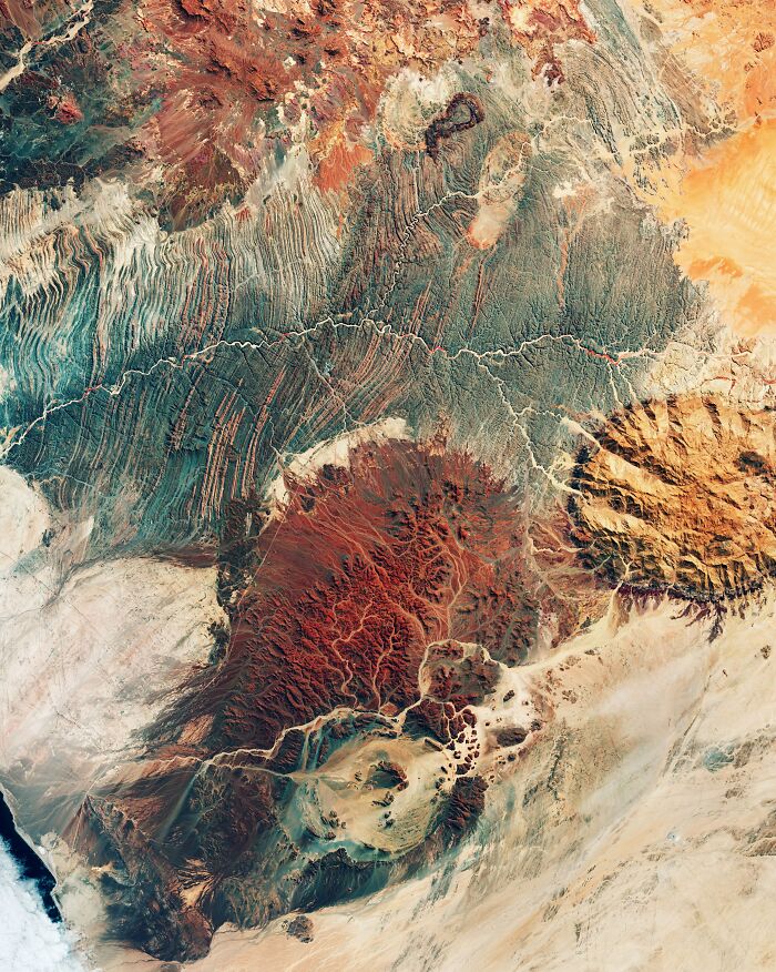
With its rainbow-colored rocks and swirling ridges, northwest Namibia could easily pass for the surface of Mars. This false-color satellite image shows the Ugab River winding across the dry landscape. It flows above ground for only a few days each year, but water hidden beneath its sandy bed keeps wildlife alive here, including the rare desert-adapted elephant. On the right rises the Brandberg Massif, a granite giant about 8,200 feet (2,500 m) tall that is Namibia’s highest mountain and home to thousands of ancient rock paintings. At the bottom center sits Messum Crater, which looks like an asteroid impact site but is actually what remains of a collapsed volcano, more than 12 miles (20 km) across.
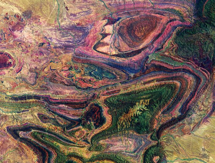
This psychedelic swirl of color is a false-color satellite image of the northern Flinders Ranges in South Australia, where different rock types show up in different shades. The park covers about 485 square miles (1,257 km²), roughly 300 miles (480 km) north of Adelaide, and is co-managed with the Adnyamathanha people, the area’s traditional owners. Its folded rock layers hold fossils of some of the earliest complex animal life on Earth, the Ediacaran fauna, which dates back more than 500 million years.
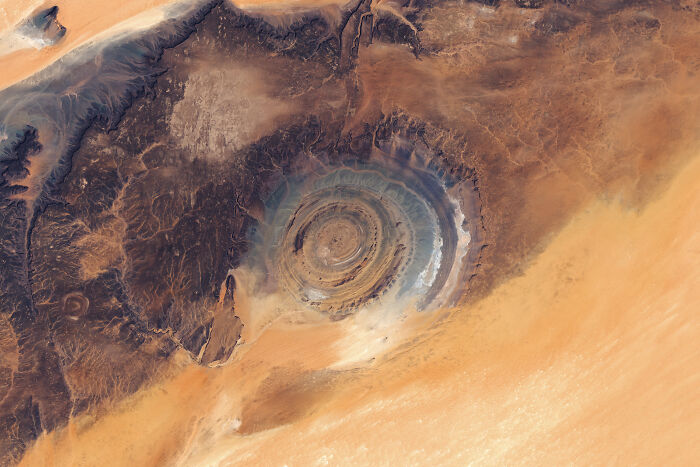
The Richat Structure looks like a giant target painted on the desert, measuring about 25 miles (40 km) across. It formed roughly 100 million years ago, when molten rock pushed the layers of the earth upward into a dome without breaking through. Over millions of years, wind and water wore the dome down. Harder rock survived as ridges and softer rock eroded into valleys, leaving these perfect rings. It’s so distinctive that astronauts have used it as a landmark since the earliest space missions.
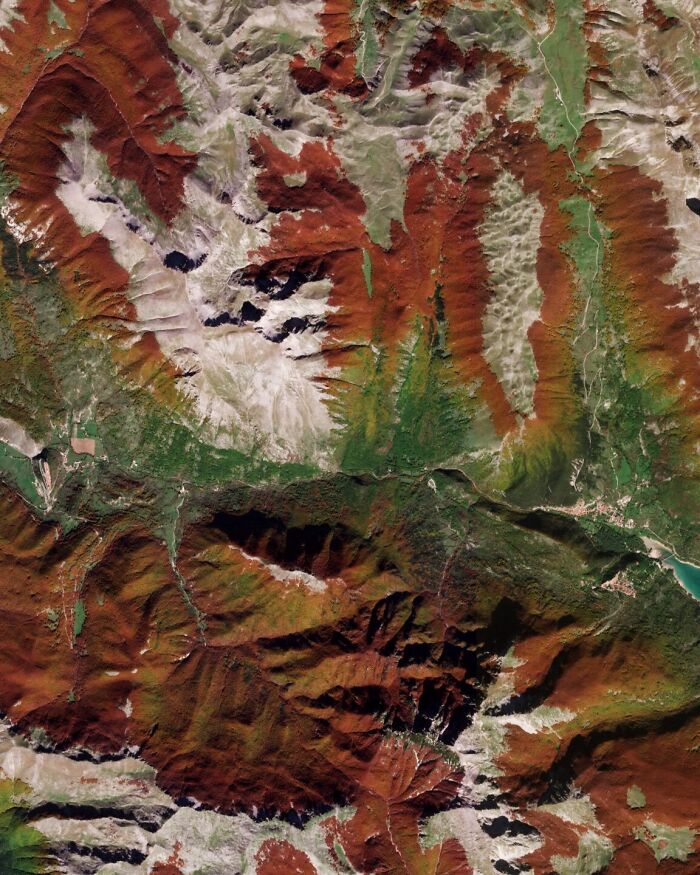
Autumn sets the mountains of central Italy on fire. Dense beech forests turn rust-red and copper, while the bare limestone peaks above the treeline stay pale gray. The exact shade of the forests depends on altitude, weather and which way each slope faces, which is why the colors change so sharply from one ridge to the next. The area is part of the Abruzzo, Lazio and Molise National Park, one of Italy’s oldest, founded in 1923. Some of its beech trees are more than 500 years old and are protected as part of a UNESCO World Heritage site. These forests are also home to the Marsican brown bear, an endangered subspecies found only in the central Apennines. A 2025 census counted just 81 of them.
Thank God some people care about protecting our planet. We are the most destructive species on earth 🌎
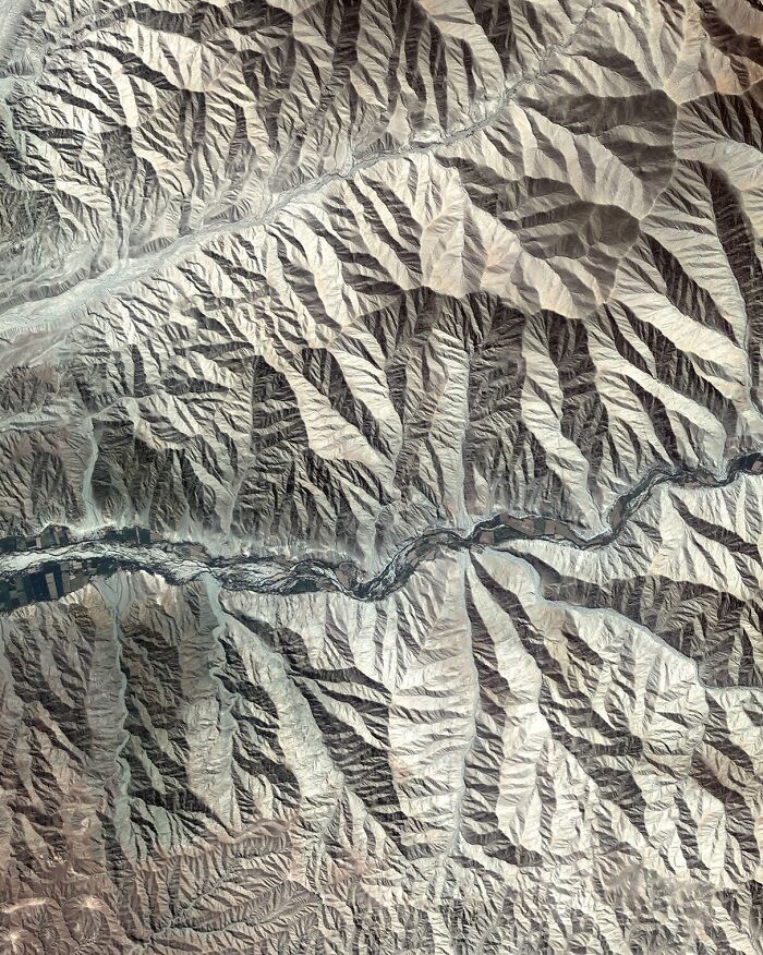
At the foothills of the Andes in southern Peru, rugged mountain slopes give way to one of the driest landscapes on Earth. Down the middle, a thin strip of farmland follows a riverbed fed by runoff from the mountains, a sign of how carefully people here use every drop of water. That skill goes back a long way: about 1,700 years ago, the Nazca people built underground aqueducts called puquios to bring water to their fields, and some are still used by local farmers today. The same ancient culture created the famous Nazca Lines, huge geoglyphs etched into the desert floor not far from this spot. The dry climate has kept them intact for some 2,000 years, and in 2024 researchers using AI discovered 303 previously unknown figures.
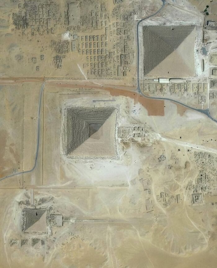
From above, you can see all three main pyramids: Khufu’s Great Pyramid (top right), Khafre’s (center) and Menkaure’s (bottom left), along with three smaller pyramids built for queens. The grid of rectangular structures around them consists of ancient tombs for officials and nobles. The Great Pyramid is about 4,500 years old and was the tallest human-made structure on Earth for nearly 3,800 years. Its sides are aligned almost perfectly with north, south, east and west.
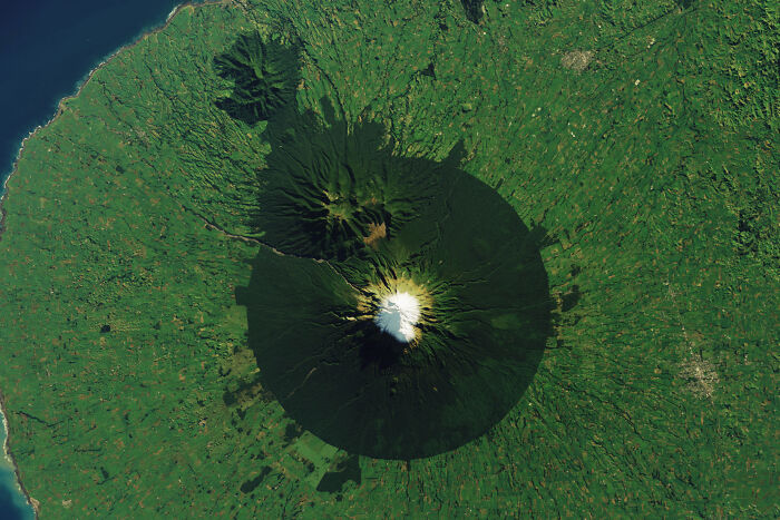
The almost perfect circle of forest around Mount Taranaki isn’t natural. In 1881, the land within about a 6-mile (9.6 km) radius of the summit was protected, and almost everything outside it was later cleared for farmland. The volcano rises 8,261 feet (2,518 m) and even stood in for Mount Fuji in The Last Samurai. In January 2025, New Zealand granted the mountain legal personhood in recognition of its sacred status to local Māori, and its official name is now Taranaki Maunga.
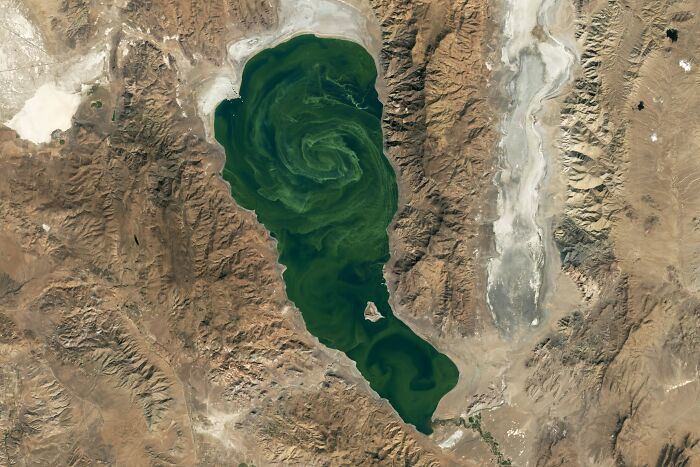
These emerald swirls are a bloom of Nodularia spumigena, a type of cyanobacteria that thrives in Pyramid Lake’s salty, alkaline water and appears almost every fall. The lake covers about 175 square miles (453 km²) and is the largest remnant of Lake Lahontan, an enormous Ice Age lake that once covered much of Nevada. It takes its name from a pyramid-shaped rock island in its southern half. It’s also the only place on Earth where the cui-ui, an endangered fish, can be found.
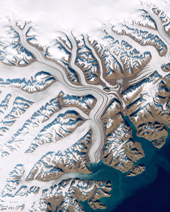
From above, Greenland’s glaciers look like frozen rivers, branching and merging as they creep from the ice sheet toward the sea. The dark stripes running along them are medial moraines, lines of rock and debris that form where two glaciers join and keep flowing side by side. The Greenland ice sheet covers about 80% of the island, and it holds so much water that if it all melted, global sea levels would rise by about 24 feet (7 m).
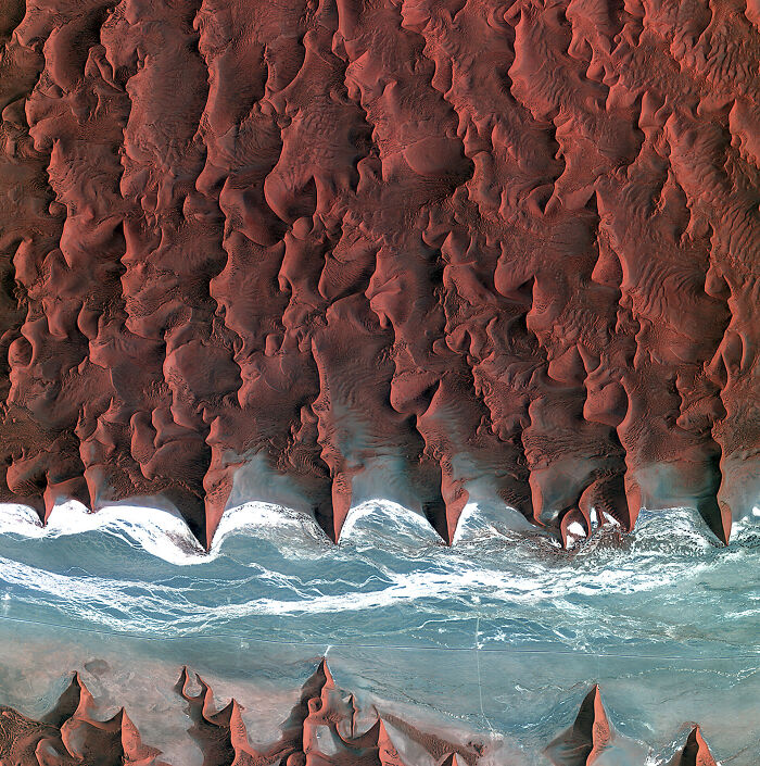
These rust-colored waves are giant sand dunes, some as tall as 1,000 feet (300 m), in the Namib, often called the oldest desert in the world. The sand gets its red color from a thin coating of iron oxide, which is essentially rust. The dunes stop abruptly at a riverbed, most likely the Kuiseb River, which flows only after heavy rains. When it floods, the water sweeps away the sand that has crept forward, so the river acts as a natural wall that keeps the dunes from marching north.
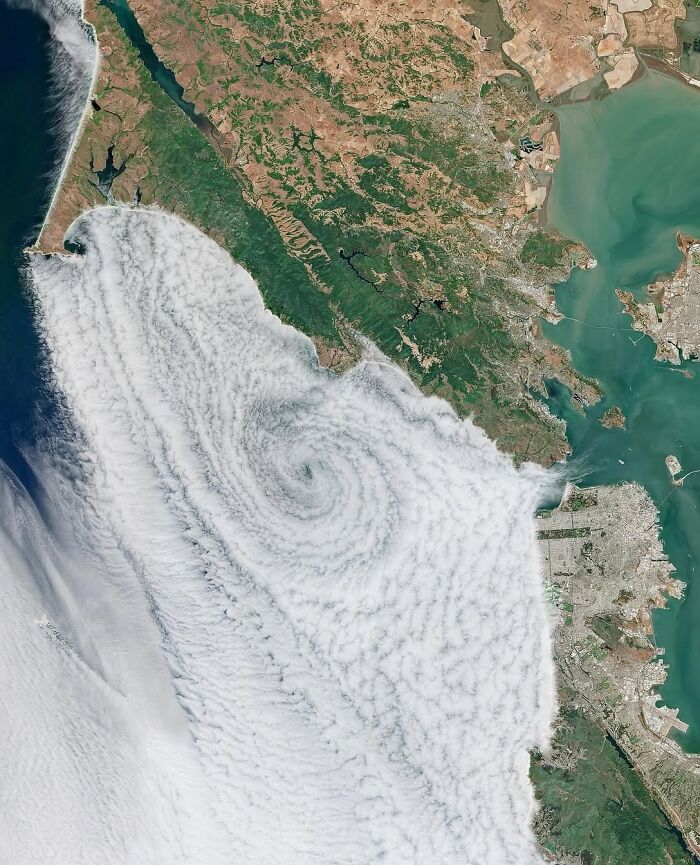
San Francisco’s famous fog spirals into a giant eddy off the coast, with Point Reyes at the top left and the city and the Golden Gate on the right. These counterclockwise swirls form west of the Golden Gate when the winds over the ocean shift slightly, and they can push fog through gaps in the coastal hills. Locals are so attached to the fog that they’ve nicknamed it Karl.
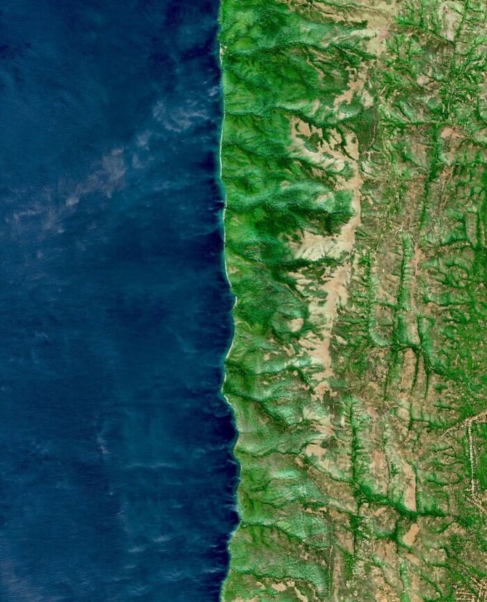
The dark water on the left is Lake Tanganyika, and the green ravines beside it belong to Gombe Stream, Tanzania’s smallest national park, covering only about 20 square miles. Steep, forested valleys run from the ridges down to the shore, and this is where a young Jane Goodall began studying wild chimpanzees in 1960. Her work became one of the longest-running wildlife studies in the world and changed how we understand our closest relatives. Goodall passed away in October 2025 at the age of 91. The lake is remarkable too: it’s the longest freshwater lake on Earth and the second deepest, reaching about 4,800 feet (1,470 m).
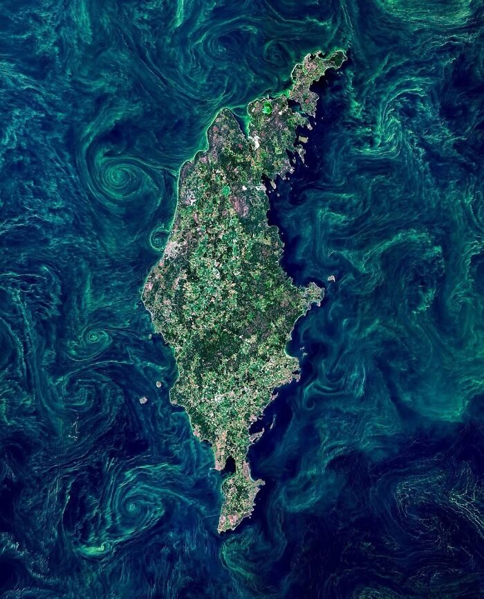
Sweden’s largest island looks like it’s floating in a marbled painting. The green swirls are blooms of cyanobacteria, also called blue-green algae, which appear in the Baltic Sea almost every summer. They’re fueled by warm, calm weather and nutrients like phosphorus, and they trace the sea’s currents and eddies. On the island’s west coast is Visby, a UNESCO-listed medieval town surrounded by one of Northern Europe’s best-preserved city walls.
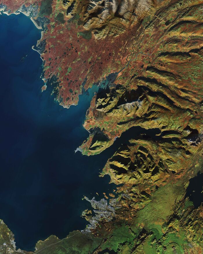
The city at the bottom is Reykjavík, the world’s northernmost capital of a sovereign state. About two-thirds of Iceland’s roughly 400,000 residents live in and around it. Above it rise the ridges of Mount Esja, with the Hvalfjörður fjord cutting inland and the town of Akranes sitting on the tip of the peninsula beyond. Iceland sits right on the Mid-Atlantic Ridge, where the North American and Eurasian plates are slowly pulling apart.
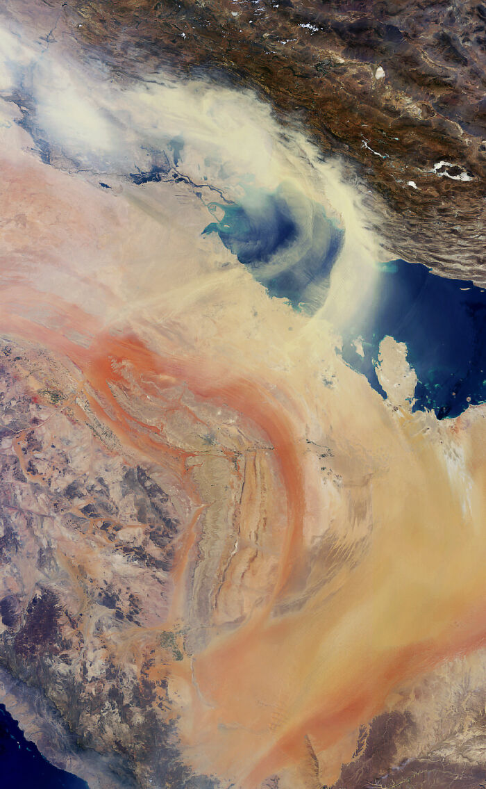
A huge wall of sand and dust sweeps across the Middle East, carried from the deserts of Iraq and Saudi Arabia toward the Persian Gulf and Iran. Storms like this are often driven by the shamal, a strong northwesterly wind that can blow for days, especially in early summer. In the worst storms, visibility drops to just a few hundred yards, which can shut down airports and ports. The rivers and marshes of Iraq are visible at the top left, Iran’s mountains at the top, and the Qatar peninsula on the right.
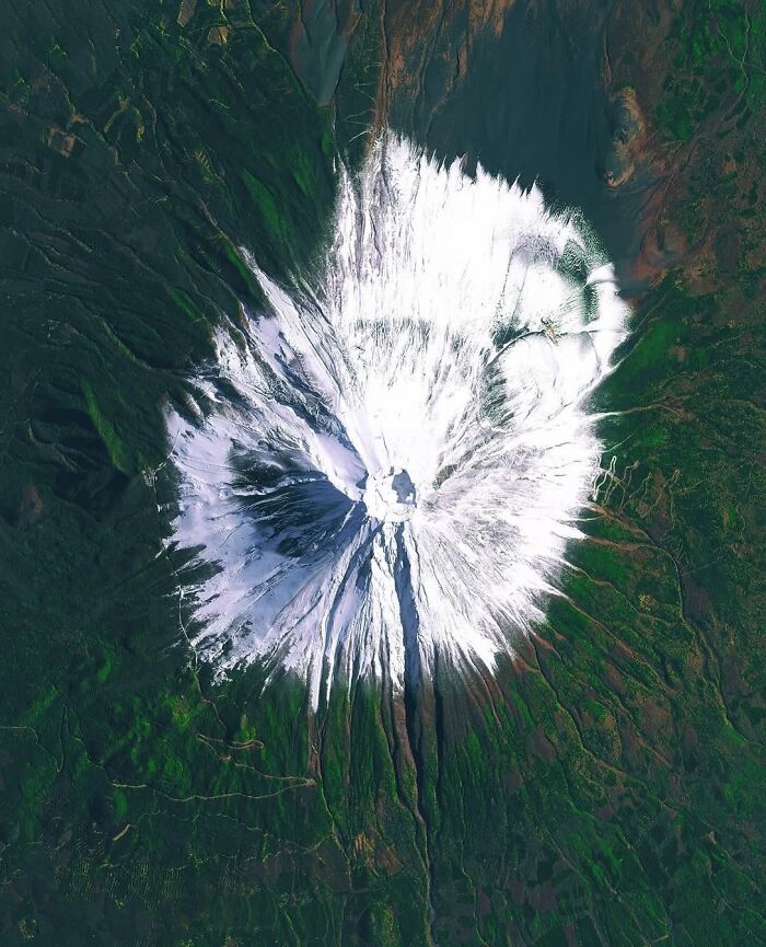
At 12,388 feet (3,776 m), Fuji is Japan’s tallest peak, and from above its snowcap looks like a white starburst around the summit crater. It’s still an active volcano, although it hasn’t erupted since 1707. Sacred for centuries and the subject of countless artworks, including Hokusai’s famous prints, it became a UNESCO World Heritage Site in 2013.
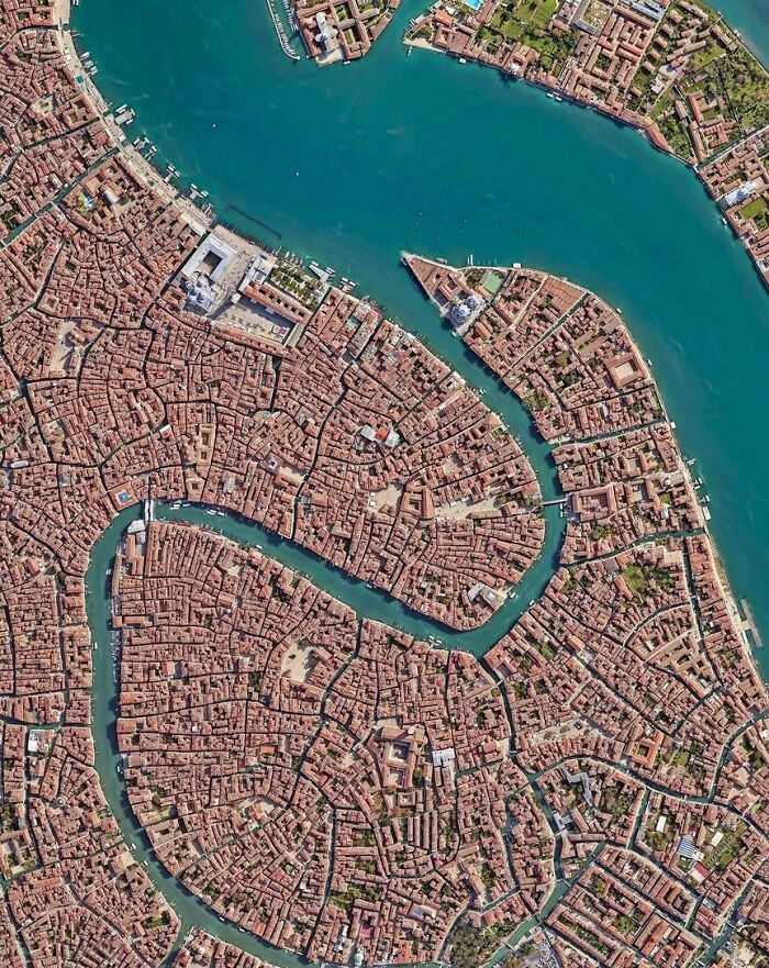
The Grand Canal snakes through the city in a reverse “S,” about 2.4 miles (3.8 km) long. Venice is built on 118 small islands linked by more than 400 bridges, and much of it rests on millions of wooden piles driven into the mud of the lagoon. Look closely and you’ll spot St. Mark’s Square at the top left and the domed Santa Maria della Salute church at the tip across the water.
It looks like every piece of that land has been consumed by humans. Crazy






































 No fees, cancel anytime