Get Premium
Dark mode theme is available exclusively for premium users. Learn more about the benefits of subscribing.
No fees, cancel anytime.

 Dark Mode Ad-Free Browsing Unlimited Content
 Ad-Free Browsing Unlimited Content Dark Mode
Join 1.2 million Panda readers who get the best art, memes, and fun stories every week!

Data analysts are a true gem in society. They gather data that’s available for all of us to see and compare. After all, humans are naturally curious, and we all love learning more and more about the world around us.
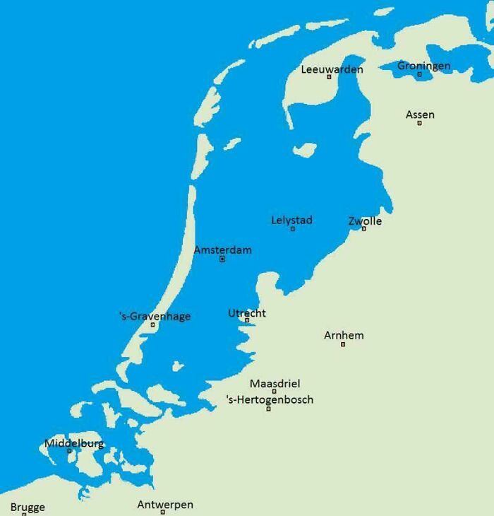
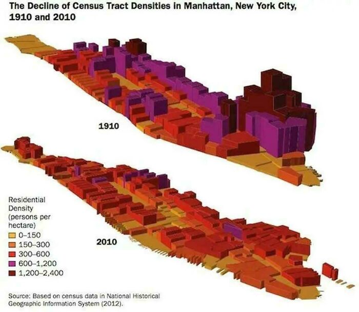
Like, which social media app is the most used around the world? What would the Netherlands look like if they hadn’t built dikes? Or what did Manhattan look like in the 1900s? Well, if these are all questions you never thought about but would love to know the answers to, we’ve compiled a list of some of the coolest and most interesting data maps for your inner nerd to appreciate.
This post may include affiliate links.

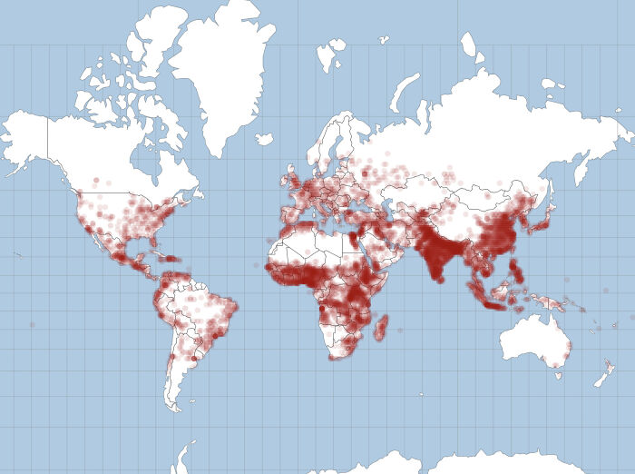
Oh sh**. Not too many decades ago I read that "rabies is the rarest of the once common diseases". Back then it was endemic in India, Pakistan and Nigeria, and was starting to make inroads into Eastern Europe. All of the Americas, all of East Asia and North Asia was rabies-free. Even about half of Africa was rabies-free.

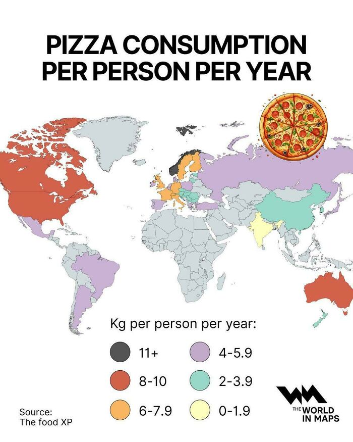
Looks like a weirdly misshapen pizza with the crust on the long side! Mmm, pizza.
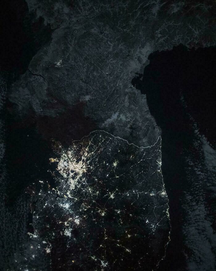
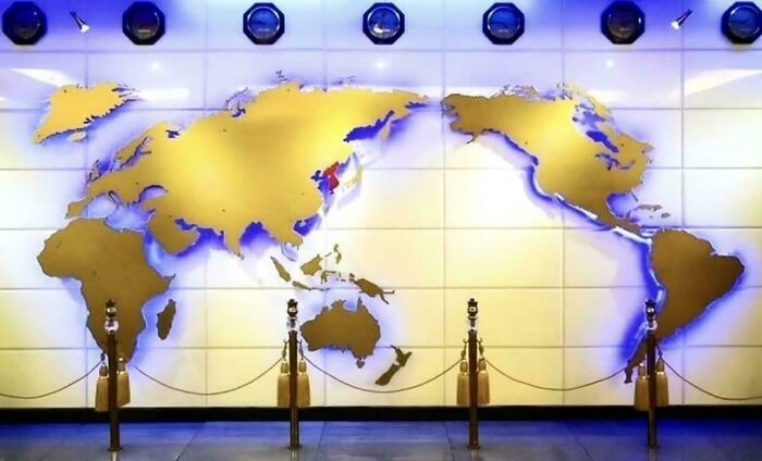
Not by "an astronaut". Almost certainly by the unmanned Suomi NPP satellite. The project involving the removal of artefacts such as clouds is known as the "black marble" project. The difference in night lighting between North and South Korea is real, I noticed it about 20 years ago. A direct consequence is that North Korea is a haven for nocturnal animals, South Korea isn't.
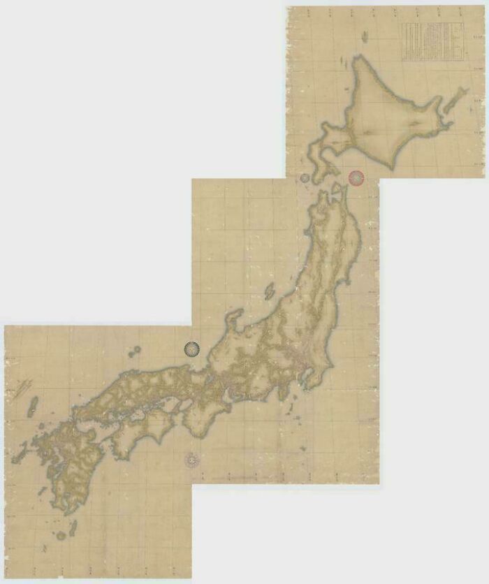
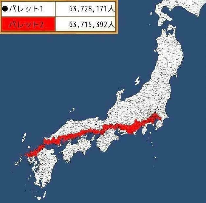
The Wikipedia entry on Inō Tadatak is worth reading. He used (then) modern surveying techniques over a period of 17 years. The map of the entire coastline of Japan was completed 3 years after his deadening, by his surveying team.

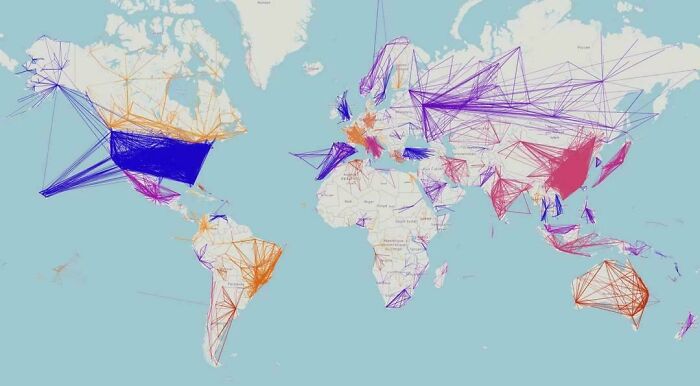
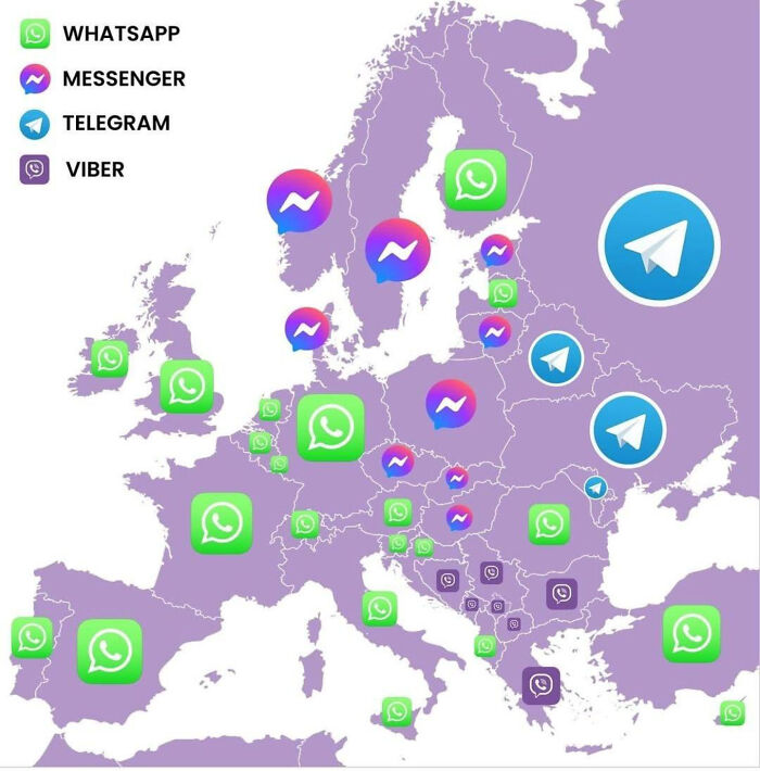
Telegram? Russians I deal with prefer WhatsApp (Serbian-based business owners from Russia)
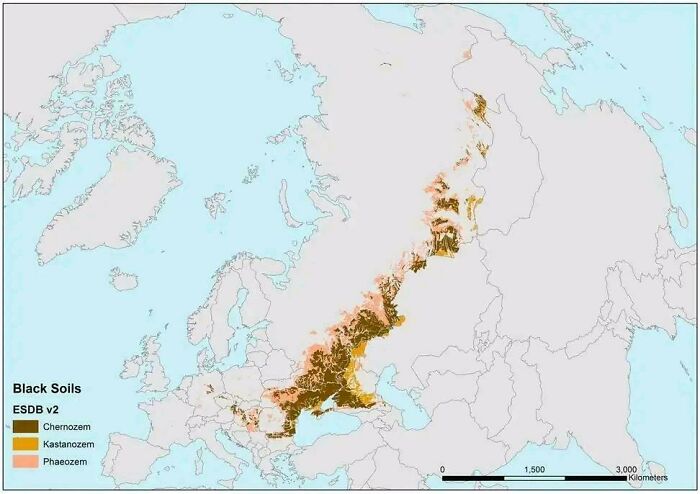
"Chernozem", geez that brings back memories. I see now why people have been fighting over Ukraine and the Crimea since the 1850s.

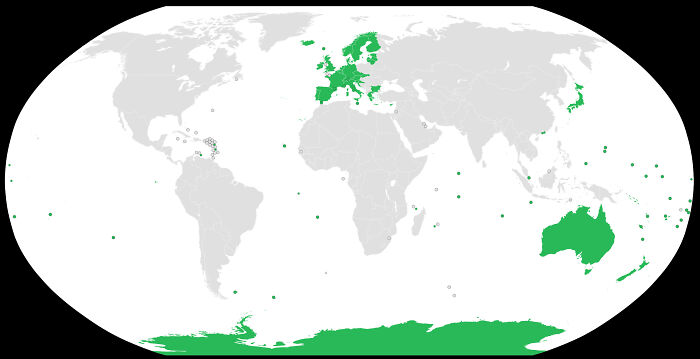
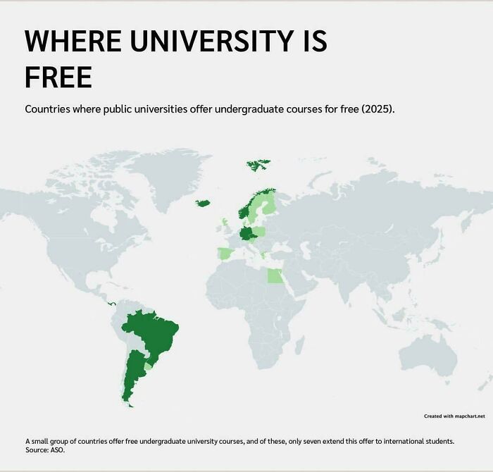
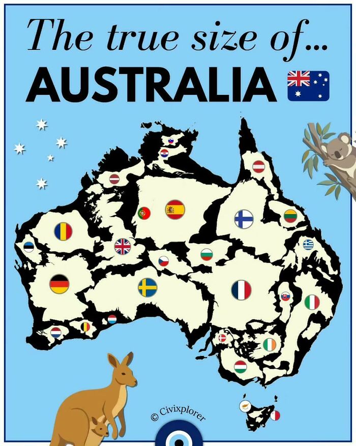
My three older siblings all went through university in Australia for free. As a result that's what I thought was normal. I was wrong. It was free for 15 years, from 1974 to 1989. They were tertiary students at the right time! I would have been too but I went straight into the workforce.
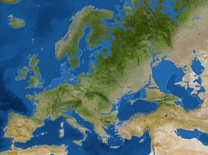
Nope. Isostatic rebound (the slow rise of land after the end of the last ice age) would change this significantly.

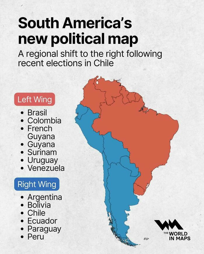
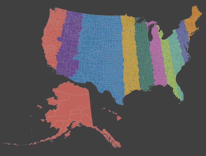
So let me get this straight....the right are on the left and the left are on the right. Pretty much sums up politics thee days

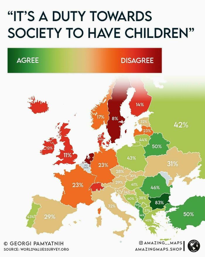
I concur with the findings for my home-country, Belgium : 'none of yous business'
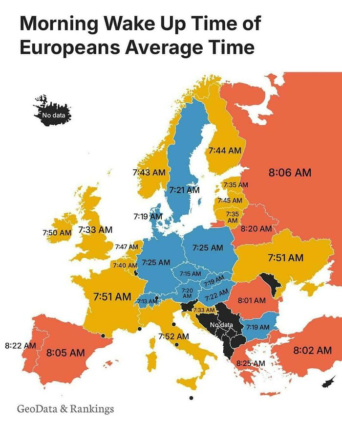
5.30 here (UK). I have lots of animals to tend to before work.
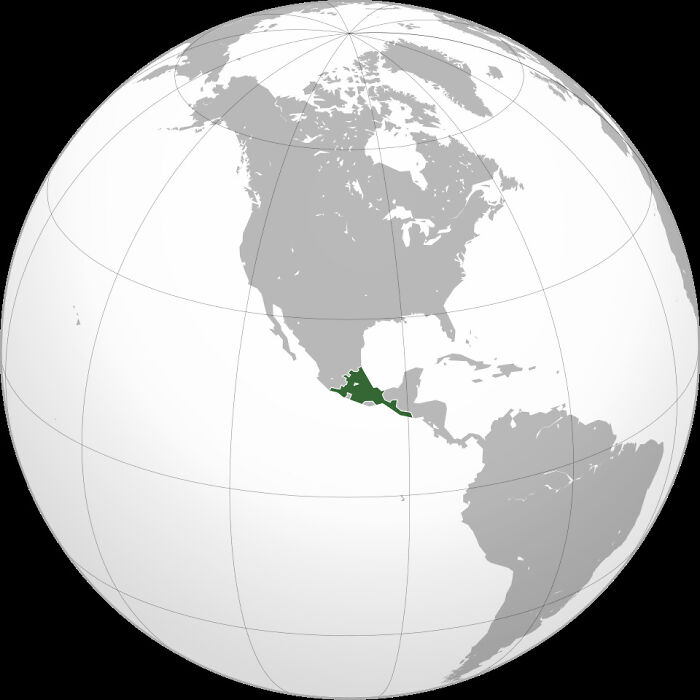
And the useful idiots in America claim that much of the SW US was once Aztec land.
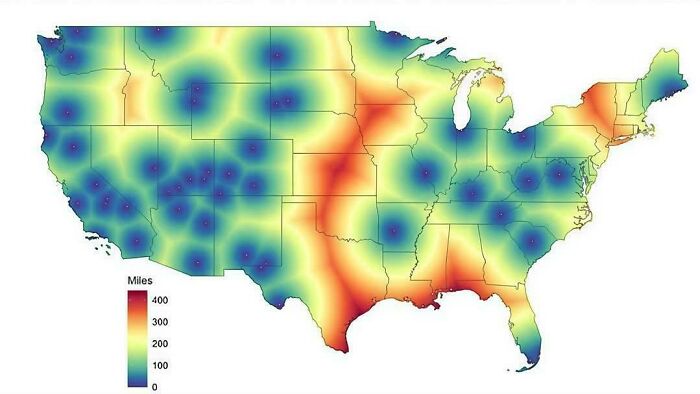
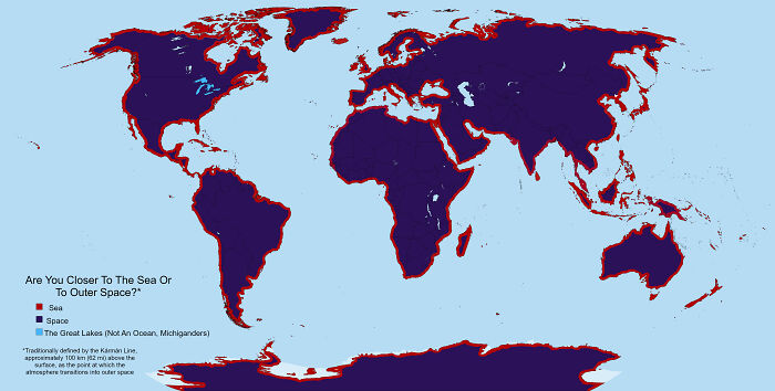
A more useful map would be distance to nearest city vs distance to space.
What month was each photo taken? Summer in the first and spring in the second?



























 No fees, cancel anytime