Get Premium
Dark mode theme is available exclusively for premium users. Learn more about the benefits of subscribing.
No fees, cancel anytime.

 Dark Mode Ad-Free Browsing Unlimited Content
 Ad-Free Browsing Unlimited Content Dark Mode
Join 1.2 million Panda readers who get the best art, memes, and fun stories every week!
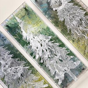
I’m a contemporary artist mixing technology, maps and old school design.
I design maps on plexiglass and hand-draw directly over the map lines creating detailed silhouettes with white ink. The map and illustrations are backed with colorful photographs that I take on location.
The final artwork is all tied together with a little engineering & zinc hardware, creating a bright and frameless layered design.
See more on ig @ http://instagram.com/modernterrain
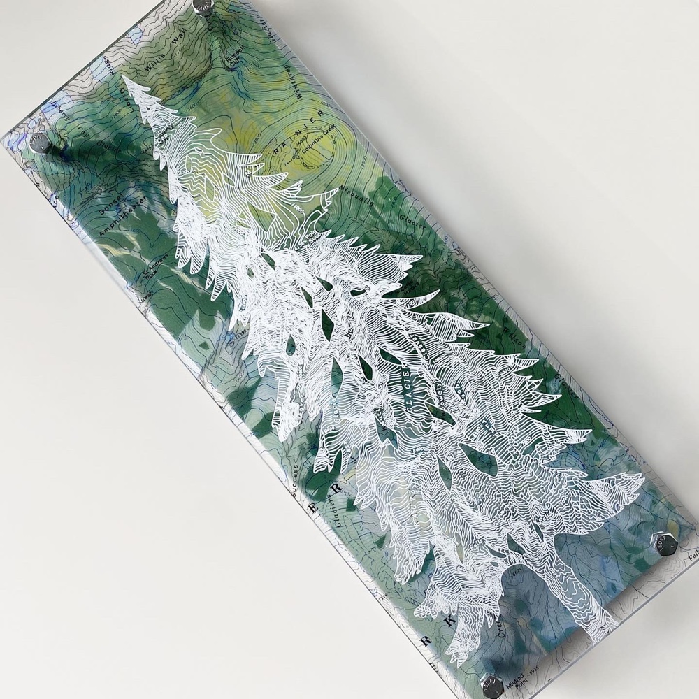
Hand drawn from the topographic lines over a map of Mt. Rainier and backed with a photo I took of some aspens
Collection of mountain silhouettes drawn from maps around the Us
2 layers of plexiglass with white trees drawn from a Mount Rainier map- background photograph taken at Paradise
Little Deschutes map featuring the Three Sisters. Backed with a photo taken on Broken Top
1958 map of Joshua Tree National park – hand drawn trees and tent using the topography. Sunset photo taken by me.
Aspen trees drawn over a vintage map of Lake Tahoe and backed with a photo I took of Aspen trees.
Yellowstone Herd of Bison / Buffalo drawn on a Yellowstone map featuring the Lamar River. Photo I took of Old Faithful in the background.
Vintage Yosemite Map – silhouette of a woman hand drawn over the map lines and backed with a photo I took of Half Dome.
Hand drawn Wasatch Silhouette drawn over a map of Little Cottonwood Canyon and backed with a photo I took of the sunset.
A little magic with a white map- trees drawn over the white lines in a topographic map on 2 layers of plexiglass and backed with white aluminum.
Commission piece of a Bear over a Mt. Shasta map, background photograph provided by the client.
The mighty Rockies hand drawn from the map lines of RMNP – backed with a digitized photo I took at bear lake.
I use zinc hardware to create space between the layers.
Before Covid I attended shows all around the US – I can’t wait to get back to it!


 No fees, cancel anytime


7
0