Get Premium
Dark mode theme is available exclusively for premium users. Learn more about the benefits of subscribing.
No fees, cancel anytime.

 Dark Mode Ad-Free Browsing Unlimited Content
 Ad-Free Browsing Unlimited Content Dark Mode
Join 1.2 million Panda readers who get the best art, memes, and fun stories every week!
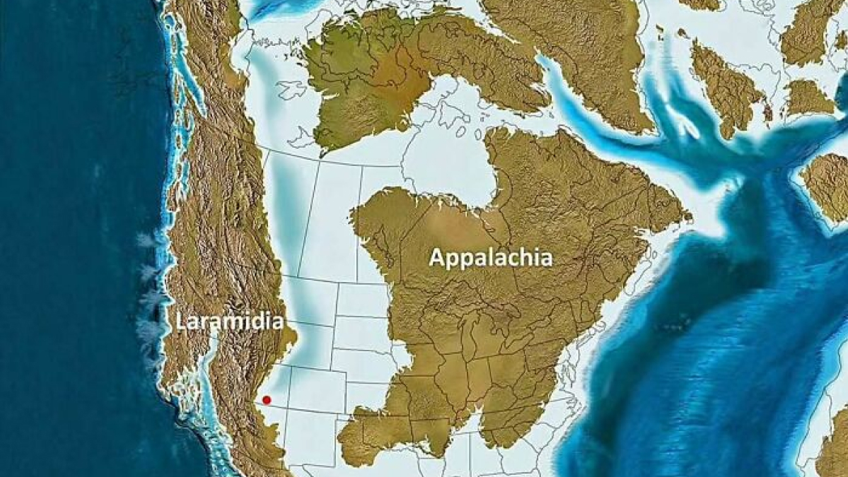
Remember those big pull-down maps in geography class? Turns out we barely scratched the surface of what maps can tell us about America. These 31 fascinating maps reveal patterns and facts about our country that might surprise even the most seasoned road-tripper. From which states prefer dogs over cats (yes, there's a divide!) to where untouched forests still stand, from wedding budgets to elevation changes that explain why your ears pop on certain drives – these visual revelations show an America you thought you knew. It's like seeing the country through a whole new lens, without leaving your living room.
This post may include affiliate links.
To think, there could be much more coverage and regularity if they had just continued to invest in railways.


 No fees, cancel anytime