Over 140 People Tried To Draw Britain From Memory – With Very Mixed Results
How hard can it be to draw the country you live in? You might expect it to be a cinch, but you’d be wrong. Premier Inn asked 144 Brits to draw the British Isles from memory, and the maps they produced range from the surprisingly accurate to the bafflingly incorrect.
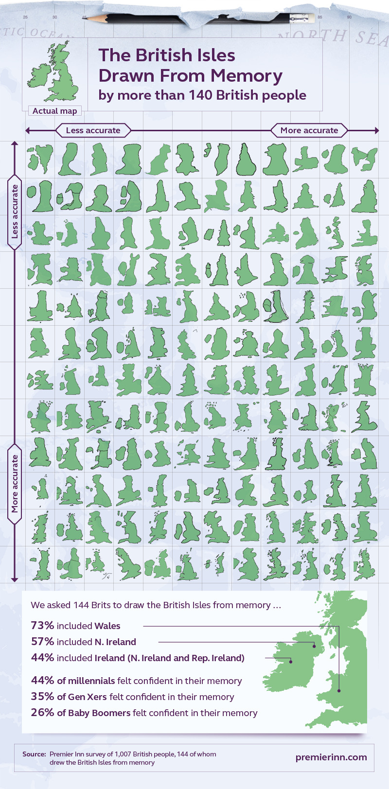
All 144 amateur maps are below for your amusement, but you may want to prepare yourself for just how wrong they are. The majority of people didn’t even remember to draw all five nations of the British Isles on their maps, making for some lumpy landmasses that would get a kid kicked out of geography class if they drew them.
That’s not all, though. Premier Inn then trained an AI to draw its own map of the British Isles based on these memory maps, and as you may have already figured out, the results didn’t exactly come out great. Wales will be up in arms, that’s for certain.
Keep scrolling to see what people think the British Isles look like according to the folks who live there!
More info: premierinn.com
144 Brits Draw the British Isles from Memory

144 Drawings of Britain from Memory from Least to Most Accurate

AI turns 144 hand drawn memory maps into the definitive map of remembered Britain

What the British Isles looks like vs. How it’s pictured in the mind’s eye of Brits

How Accurate Brits are at Location Belfast on a Blank Map

How Accurate Brits are at Location Edinburgh on a Blank Map

How Accurate Brits are at Location Cardiff on a Blank Map

How Accurate Brits are at Location London on a Blank Map

How Close Brits Were When Asked to Locate Their Hometown on a Blank Map

Where the North-South Divide Lies According to 184 People

126views
Share on Facebook

3
0